21 December 2017
The Mount Yonah hike is described as “moderately strenuous” and “hard” hike. I concur. As you leave the trailhead, you immediately begin to climb. Gradually at first, but then it gets steeper and the trail rockier. Atlanta Trails calls it a 4.4 mile round trip hike and it feels like it. The peak is 3,166 feet high and your elevation gain from the trailhead is 1400 feet. Atlanta Trails has an excellent description of the hike and I used their distances in my descriptions.
Two guys set off as I pulled up and one said he would have hot tea waiting for me at the top. (I’m still waiting for the tea!) Another group pulled up and beat me on the trail by a few seconds but quickly out distanced me
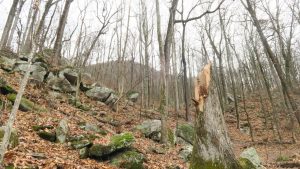
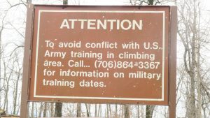
At mile marker 0.3, you cross the fanciest bridge I’ve ever crossed on a hike, that’s probably due to Army Rangers.
Around the 0.5 mile mark you go through a series of switchbacks as it progressively gets steeper. On my way back down, I passed several day hikers that looked as if they were in over their heads on this section.
At 0.8, someone had put a series of cut stone steps to ease your climb to the next switchback. The trail at that point actually begins to descend significantly until you round the base of the mountain. Once around the base, you then climb at a steady rate. About this time, I was stopping every few yards to catch my breath.
Mile 1.0 has a short scramble over a boulder field that was more fun than difficult. However, I wonder how some of the dogs on the trail will handle it? Perhaps better than their owners.
Mile 1.2 is a clearing with a majestic boulder overlooking the valley. This is apparently a popular campsite. The incline gets steeper and rougher due to erosion of the trail until you reach 1.6, the ranger station and landing zone for their helicopters. They have the most outdoor toilets I’ve ever seen at a site – six.
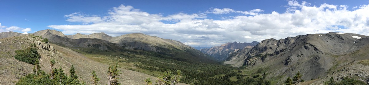
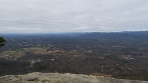
From hereon, you pretty much follow a gravel road until you are near the summit. Then it is back to trail, boulders, and as you round the bend is a jaw dropping view of the valley below. You get a tinge of vertigo standing near the edge.
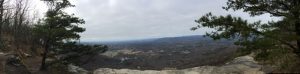
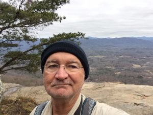
I followed the trail upward and made the summit which is a large bald (and helipad). I back tracked a little to the cliff edge and had lunch overlooking the valley.
I admit I am slow, but I’m old. I can climb for long periods of time as long as I take numerous breaks. However the downhill part takes a toll on my hips and knees.
As I was finishing lunch, the group of three who beat me to the trail started their descent. I think they were surprised, but pleased I made it to the top.
The trip down was faster, but in someways tricker with the loose rocks. It took me a little over 2 hours to make the climb and about an hour for the descent.
Everyone on the web raves about his hike and I can see why. It challenges you but pays off in the end.
On the way back to the lodge, I took a side trip to Sautee. This is a really quaint little village that has made the most of old buildings, converting some into gift shops, sandwich shops, potteries, etc. It isn’t nearly as touristy as Helen.
I stopped to get a sandwich for dinner and bought my required amount of taffy.
Tomorrow, I start the trek home with a night in Orlando.
You got me taffy? Sweet. Except every crown in my mouth would pull out. I am sure it would be worth it.
Holley would like you to go with us to Kansas next year. I promised her we would hike Pikes Peak (7510’ from the bottom to the summit). She will bring some cookies if you will fill a backpack up with martinis. You two can put me on a litter and we should be on top in 4-5 days. Holley was fine there, but Maureen developed vertigo and Betty got a bloody nose. However, a good time was had by all. I think my dad said he drove to the top there, but he may have been bragging. He claimed that Barney Olds was his wing man.
Works for me, especially the cookies!