4 May 2018
What a great day! The weather was perfect, the sky was blue, and my ankle didn’t bother me too much. I also think I might have a new “favorite” national park!
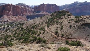
As I mentioned yesterday, I ultimately decided to hike the Chimney Loop. Fortunately, the loop was 3.8 miles round trip, not one way. I started the hike at 9:09 am and finished 2 hours and 23 minutes later. This is a spectacular hike.
All Trails recommended that when I come to the junction of Spring Trail and the Loop, to hike the loop counterclockwise. That’s the steepest ascent and I wanted to tackle that first thing. The trail is rated as strenuous but I didn’t have too much trouble.
I did run into an Australian couple and the guy kept wanting to give me lessons in geology and show me his gps. He is a retired electrical engineer. I think his wife mostly humored him. He really just wanted was to rest before continuing to climb. Let it be known that they passed me on the trail but later I passed them and finished the trail well ahead of them.
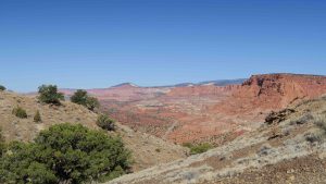
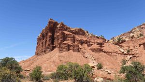
This loop is rated as one of the best hikes in the park and I cannot help but agree. The top of the ridge lets you look down on The Chimney, 300 feet above the floor so the trail at the top was at least 350 or 400 feet.
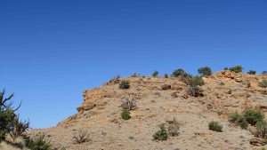
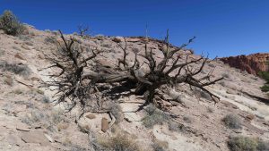
There are two gymnosperms dominant here: the two needle Piñon Pine (Pinus edulis) and the Utah Juniper (Juniperus osteosperma). Both leave beautiful driftwood-like shapes on the landscape. Most of what I saw as dead was Utah Juniper.
At the top of the ridge, I could look down on two places I visited yesterday: Panorama Point and Gooseneck.
I also got a different view of Fluted Walls.
After I finished, my gps said I traveled 3.85 miles. The Australian couple said 5.75 miles and 640 feet elevation gain. I think they were using kilometers instead of feet and miles.
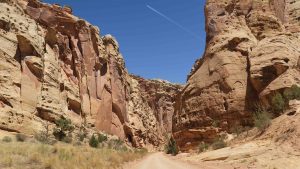
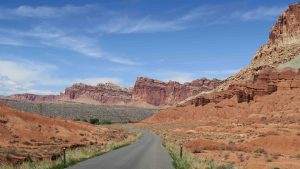
Next on the agenda was to drive the Scenic Drive. It’s a ten mile road that ends in Capitol Gorge. The scenery here is amazing.You drive down a canyon with sheer walls to either side of you and constant warnings to not be in that location during flash floods.
The place was packed and even when it changed to dirt roads, the traffic was pretty heavy. Some of the views are worth a mention.
One of the formations is known as Egyptian Temple. What a strange rock formation!
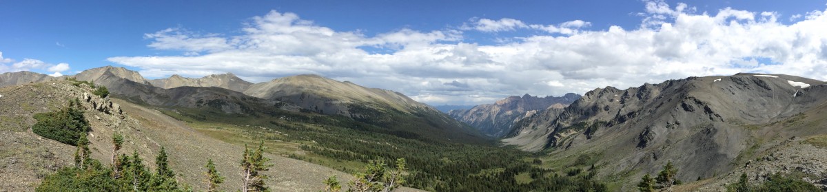
As I drove back the 10 miles to US 24, you got a magnificent panoramic view of Capitol Reef National Park.
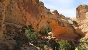
As I say, in for a penny, in for a pound, I headed to Hickman’s Bridge. This is a 1.9 mile round trip to a natural bridge.
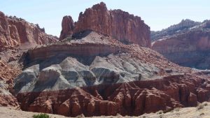
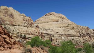
One part of the trail affords the best view of Capitol Dome. The white sandstone is known as Navajo Sandstone and it gives the park its name.
It’s all uphill at first and you gain 600 feet in elevation as you hike up.
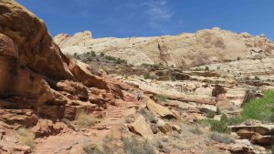
At mile 0.9, you come to the bridge. It’s pretty amazing and you can walk under the span. This is the first time I’ve known the public to be allowed to walk under the span of a natural bridge. As a matter of fact, the loop requires you to walk under the span.
My last stop of the day was at The Petroglyphs. How anyone got up on the side of that cliff to do these is beyond me but they were impressive. I suspect they were about 60 feet off the ground and each petroglyph was probably at least a foot in height.
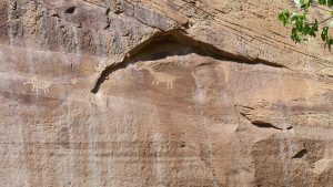
They were also some of the most well formed ones I’ve seen.
I ended my day with a shower and an enchilada dinner at a local Mexican Restaurant – Le Cueva.
I’m up in the air about tomorrow. I could do some more hiking but I can tell my ankle is sore from the last hike. I did a total of around 5.85 miles today. Some of the Hickman Bridge trail was very rough and rocky and it took its toll.
An option is to drive 185 miles south of here to Grand Staircase-Escalante National Monument. This is one of those that the Trump administration is cutting back the size – along with Mules Ears. I’ll let the ankle decide tomorrow.