7 May 2019
I think I overdid it with my ankle today. The distance wasn’t so bad but the up and down was pretty constant. More Advil tonight. I must be getting old. I can’t hike the distances I used to be able to. I did a total of 5.3 miles today and was tired!
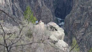
I started out early and was on the Oak Flat Trail by 9:30 am. A couple started the trail before I got on it and I never did catch them. I did get a photograph of them resting much further down the trail and very close to the last jumping off point to the bottom of the gorge.
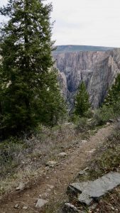
I don’t think I’ve walked a steeper trail going downhill than the beginning of the Oak Flat Trail. I’m not sure of the grade but I suspect it was over 25% in some places.
Usually, when the descent is that steep (the trail drops 400 feet from the rim) that means it’ll be a bear to get back up. However, the trail up was more gradual than the descent and did not cause me any problem.
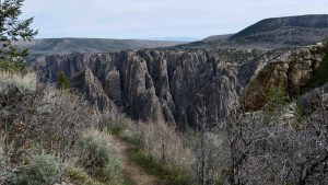
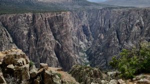
Every so often you would make a switchback and the vista of the canyon opened up before you.
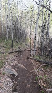
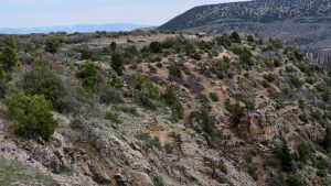
After getting back to the top, there was a trail branch for the Upland Trail. I was hoping for more, different wildflowers but the trail disappointed. Actually, I think this would have been better named Oak Flat Trail. It was pretty flat and had a lot of oaks and not much scenery. You cross the park road twice as you swing back towards the visitor center.
At one point of the Upland Trail, you get a great view of Tomichi Point. You actually walk the south rim of the canyon and climb to Tomichi Point. From there it is a quick walk to the visitor center where I had parked the jeep.
The Oak Flat Trail is 2 miles and the Upland Trail is 2 miles, so you do the math.
I then drove to Warner Point. Warner was pivotal in getting Black Canyon designated a national monument back in 1933. He convinced the town of Montrose to build a road to the canyon which, of course, led to increased tourism.
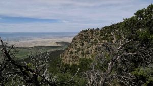
Warner Point was his favorite place in the park. Round trip it is 1 1/3 miles. This was the part that did my ankle in. It was down, then up, then down then up, then down and finally up to the point.
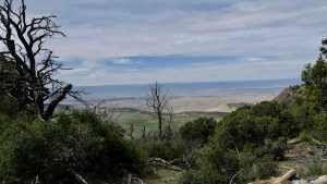
The view was probably the best overall view of the canyon and it is the deepest part of the canyon at 2700 feet.
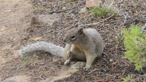
I had company on the last part of the hike. He seemed as curious about me as I was about him.
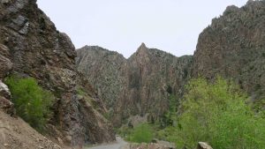
The final part of the day was a drive to East Portal. This is a drive to the bottom of the canyon where the dam is located. Montrose needed water and the Black Canyon of the Gunnison had it. The problem was how to get it to Montrose. In the early 1900’s Abraham Lincoln Fellows and William Torrence were the first people to traverse the river down the canyon in rubber rafts. They were surveying the canyon for a tunnel to Montrose.
They found a suitable site for the tunnel and construction of the 5.8 mile Gunnison Diversion Tunnel began in 1905 and dedicated in 1909. It is still in use today.
The road down, of course, had hairpin turns but more importantly, the grade was 16%. That’s the steepest grade I think I have ever driven over any length of road. It was pretty much 20 mph in first gear all the way down.
At the end of the road is the dam and tunnel.
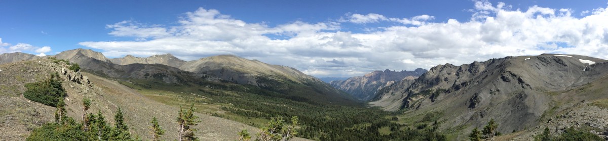
Tomorrow I plan to drive over to Ouray, Colorado. Someone, I can’t remember who, Jim Wilson, insists I see this town of around 1000 people. It should be an interesting drive. The town is found a valley surrounded by mountains. Wilson waxes poetic about this place so I better not be disappointed or he’ll never hear the end of it.