16 May 2018
I was talking with our camp host, Melissa, and she informed me the burn was a prescribed burn. My thinking is it may have started out as a prescribed burn but it looks as though it got a little out of control. In any case, it’ll grow back.
It’s 68 miles to the north unit of Theodore Roosevelt National Park from the south unit. In some ways, the scenery is more spectacular in the north unit but in others, the south unit has more to offer. Like the south unit, the roads were under construction but no one had started to work when I arrived.
There is a 14 mile road that ends at Oxbow Point. Once I made it there, I retraced and stopped in at the Juniper campground. I met a couple that were the hosts and they were from Tallahassee. They also informed me Melissa is from Mississippi. Small world.
While driving the road, I first stopped at Caprock Coulee. It has a 1 mile nature trail and a 4.3 mile loop. I thought I might try that after completing the scenic drive.
I continued and next stopped at River Bend Overlook. The Civilian Conservation Corps (CCC) built and observation shelter on the point and you had great views of the Little Missouri River. You could hear those damned geese calling to each other from the point.
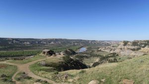
Oxbow Point refers to an oxbow and is what we in Mississippi know as where the Mississippi River makes a “U” turn. Often, the river will change course and seal off the “U” to form an oxbow lake. Since I was on what appears to be the highest point in the park, it was a great view of the valley floor below.
I returned to Caprock Coulee and decided to do the 4.3 mile hike. My ankle was feeling pretty good. I met the couple at the south campsite that is doing a tour of western parks. They and their two young children intended to do the 4.3 mile loop also. I got off before they did and have no idea as yet if they completed the loop. It would be a little tough with young kids.
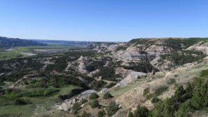
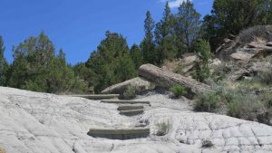
The loop is rated as moderate with steps. Emphasize steps. Fortunately, the trail insists you start in a valley and it leads you up a gradual climb to the top of the plateau. If you had been hardheaded and tried to hike the trail backwards, you would have been in one of the steepest climbs I’ve ever seen in hiking. Fortunately, if you complete the loop, that means you are doing the steepest part downhill.
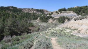
The trail takes you through coulees, forests, and eventually brings you to the top of the plateau. The forests are tick cities. I’ve pulled five off of me since I completed the loop. The entire hike took me about 2 hours and 45 minutes (the sign suggested 3 hours) so my time was pretty good.
Of course, about 2 miles into the hike, my feel good ankle started not feeling so good. I debated as to ask for a ride back down once I reached River Bend Overlook but decided to press on – glutton for punishment that I am. I would have been a great religious flagellate.
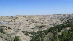
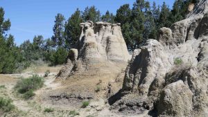
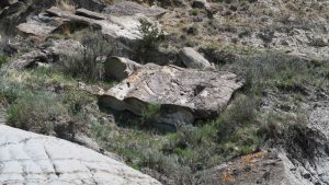
One really strange feature I came across was two large sandstone formations that at first I thought were petrifactions. No, they were just unusual sandstone formations.
Next to them was a massive wavy formation of sandstone that was intriguing. I can’t imagine what caused those peculiar formations.
Tomorrow, I head for Voyageur National Park in Minnesota. I’m staying at a lodge called Ash-ka-nam in Orr, Minnesota. From there, I’ll do short day hikes in the only part of the park you don’t have to canoe. Most of Voyageur is waterway where you canoe, portage, canoe, portage, ad infinitum.
Voyageur is close to the Boundary Waters of Minnesota. I’ve canoed those waters 3 different times. The first time was with a local north Mississippi council Boy Scout trip. The second time was with a New Orleans Boy Scout council and the last time was in graduate school with graduate buddies. I’ve done all the canoeing (and more) that you could do in Voyageur.
It’s a 10 hour plus drive, so I’ll be ready for a shower, clean sheets, and soft bed.
Glad you avoided the deadly moose, grizzly, and grouse. I am afeared that you have gone too far. My favorite spot was the Ft. Randall dam on the Missouri River. The fish coming over the spillway are ginormous.