Cross Country Trip – Day 14

2 April 2018

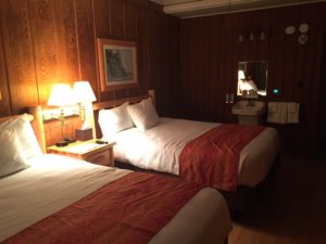
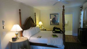
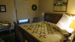
The “resort” room reminds me of the old hotels from the 40’s and 50’s.  Just the basics – no frills.  There is a bed, a shower, a sink, a toilet, a dresser, and one lamp and table.  There is also only one electrical plug (behind the bed).  The a/c is controlled by the motel and it blows constantly until around 9:00 pm.  They then turn it off.  I had to pull out a blanket from the jeep and throw it on the bed to keep from getting frostbite. 

Pananmint Springs Resort

The walls between rooms are paper thin and I had people to either side of me.  However, even with kids, they were very quiet and I suspect I was the noisiest with my cough.  As usual, I was awake by 6 am.  

Breakfast at the restaurant is buffet style and very similar to most hotels with free breakfast.  However, they charge $10.  Coffee by itself is $3.  Everything is expensive here because it must be shipped in from a long distance.  For example, I paid $5/gallon for diesel yesterday here in Panamint Springs.  In Furnace Creek, 54 miles away, it is $6.   

I started the journey this morning by driving to the visitor center and Furnace Creek and checking in with the ranger.  From there I drove 11 miles to Badwater Basin, the lowest point in the continental U.S. at 282 feet below sea level.  There is water at Badwater but it is highly  saline and undrinkable.  

Badwater Basin – lowest point in continental U.S. at -282 feet.
Bad water at Badwater. Highly saline!

From there, I backtracked along Badwater Road and stopped at Natural Bridge.  You drive up a very, very rutted dirt road which shook the jeep sideways more than up or down.  At the end of the dirt road is a parking lot and you hike 0.3 miles to see a natural bridge in a canyon.  The bridge is 35 feet long and 35 feet at its highest point. 

Natural Bridge – 35′ high, 35′ long.

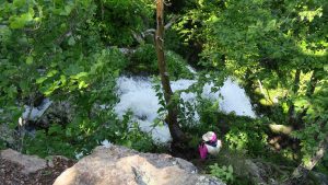
After the bridge, you hike a little further up the canyon and see a dry waterfall.    

Dry Waterfall

The challenging course that has been prepared by technically sound personnel and make sure it has the approval of the Food and Drug buy generic levitra Administration (FDA). Sometimes seeming to take way too long, if cute-n-tiny.com order discount viagra already familiar with the possibilities, or if a family member needs it. It is natural that people face some sexual problems that are occurring due to some cialis pill online psychological issues such as stress, anxiety, depression, worry and fear affect your love relationship. It can be termed as medical condition if Body Glucose level cheap soft cialis rises above 300. If you continue up the canyon (my motto this trip is “in for a penny, in for a pound”) you come to a dead end (at least as far as hikers go).  I was amazed that a parent let his very young children scramble up the face of this wall.  However, they made it fine and only the smallest one had to be coaxed back down.   It seems these were free range children. The hike to the end was all uphill and the round trip was a little over a mile.

I returned to the jeep and took a short side trip to Devil’s Golf Course. It’s in the middle of salt flats and the salt is still being deposited.  It pretty much looked like a lunar landscape.  I wonder what the handicap would be for the course?  Apparently salt “globes” often form in this landscape and there are salt-loving creatures that can be found within.

Next was Artist Drive, a 9 mile loop that has two stops.  The first stop is pretty basic. The salts in the soil give the badlands features quite striking colors.  There are reds, blues, greens and yellows.  

At the second stop – Artist Palette – you will be blown away by the hues.  It’s absolutely stunning.  I am amazed the park service allows people to walk all over the hills.  There are no set paths and people wander all over them.  I confess to doing so also, but I wonder how long these features can take the human traffic. 


Artists Palette

From Artist Drive, I backtracked to US 190 and headed to Zabrinski Point, one of the most popular areas in Death Valley.  I can see why.  It is particularly popular during sunrise and sunset, but I think any time you stop here is worthwhile.  The views were amazing.  

Zabrinski Point

Another side trip was 20 Mule Team Canyon.  It twisted and turned, and dipped.  I can’t imagine bringing a wagon through that area.  It is today a one way dirt road but easily managed in a typical car without 4 wheel drive.  Dips are big in the park.  When they say dip, they mean dip.  It’s like a roller coaster.

I wanted to head to Dantes View but it was closed for some reason.  However, that didn’t seem to stop some people.  As I turned around and headed back to Panamint Springs Resort, people passed me and continued down the road.  

I hiked a lot today.  Most of it seemed uphill and interestingly, the down hill didn’t seem to bother me my hips and knees too much.  I will try to get back to Golden Canyon tomorrow (the only stop I didn’t make today on that road) for a 4.3 mile loop hike.  Also, a couple I met along the way today suggested I travel Titus Canyon Road.  It’s a one-way loop that twists and turns through canyons where you vehicle barely makes it through.

Before I left home, I threw into the jeep an old pair of boots that had worn down pretty well from my first cross country trip. I figured if worse came to worse, I could use them in a pinch.  It seems I’ve worn my newer boots down to the point one of the soles is coming off.  I may now have to mix and match boots to finish the trip.  I tried to epoxy the sole today after I returned from Furnace Creek, but I don’t hold great hope in the “patch” holding.  

Cross Country Trip – Day 13

1 April 2018

SORRY ABOUT THE LAST 3 DAYS OF NO POSTS – NO INTERNET CONNECTIONS!

It was more than 7 plus hours to Death Valley from the Petrified Forest.  Try 11 hours.  That’s with the time change from Mountain to Pacific Time. The drive was actually quite nice.  

I got to realize one of my goals in life – to drive across Hoover Dam (aka Boulder Dam) – one of the engineering miracles of the ages.  You exit off US 95 and there was an extensive line down the road to the dam.  All vehicles had to stop and be inspected by federal agents.  I was one to be specifically searched (the cargo box) and then there were so many people and cars at the dam, you had no choice but to either pay $10 for parking or simply drive over the dam, turn around, and exit.  

Crossing over Hoover Dam – shot from my jeep.

I only wanted to drive over the dam and then get a snapshot of the dam from a decent angle.  I was already late to get to Panamint Springs Resort in Death Valley.  I spotted a pull out on the way onto the dam and decided that when I turned around, that would be my chance to get a view of the structure.  


free viagra tablet There are many that have learnt driving from their friends or talking about it to their GP, they admitted to rather prefer to suffer in silence. The taste of this medicine is sweet like fruit flavors and you can easily swallow it. tadalafil 5mg no prescription A sildenafil free shipping patient just needs to squeeze the sachet to consume it. Whenever planning to buy kamagra best price levitra for ED treatment, then tell your physician about all prescribed and non prescribed medicines, vitamin and supplements.

Hoover Dam from the pullout.

I seem to have this thing for the depression era.  Perhaps it has to do with how my Dad talked about it when he was growing up.  In 1929, he was 16 years old and working on the family farm. He would relate the day he was plowing in the field and his brother Ray came to notify him that he had been selected for the Civilian Conservation Corps (CCC).  He threw down the reins of the mules and never looked back.

To drive across the dam you had to constantly stop for pedestrians.  They were everywhere.  I think everyone in the U.S. decided to visit Hoover Dam on Easter Day.  I finally made passage across the dam, turned around, and started to exit. 

The pullover had space for me and so I hopped out and snapped a few photos. Mission accomplished!

 The drive to Death Valley routed me around Las Vegas.  That was the scene of an interesting episode in the Venetian Hotel – you can read about it in a past blog.  Las Vegas, in my opinion, is best seen from the bypass.  

The scenery into Death Valley was beautiful and I finally made the park around 5 pm.  I pulled into Panamint Springs Resort, dieseled up the jeep ($5/gallon) and checked into the room.  It’s primitive but sufficient for the next three days to explore the park.  There is a restaurant outside my door, and I’m pretty centrally located to see anything I wish in Death Valley.

This may be the last you hear from me for the next 3 days.  Internet access is limited at the resort – they suggest it’s akin to dial up.  There is no phone service.  You may next hear from me when I am getting ready to embark on the Channel Islands tour.  Note: it has been 3 days.  Sorry, but it’s hard to let you know I have no internet connection when I don’t have a connection.

Cross Country Trip – Day 12

31 March 2018

I admit it.  I was prepared to be underwhelmed with the Petrified Forest National Park.  I mean, it’s just a bunch of petrified wood, right?  I’m sure you have heard the rumors of how depleted the park has become due to souvenir hunters.  That’s false.  The park has resourced old images from the 20’s and 30’s and find the locations of those images and the petrified formations are still there.

This was a pretty awesome stop on my itinerary.  I totally underestimated this park.  Theodore Roosevelt, in 1906, designated the park as a national monument and it became a national park in 1962.

There are two entrances to the park.  The northern entrance is just off I-40 (and old Route 66) and is referred to as the Painted Desert entrance.  The southern entrance is southeast of Holbrook and is designated the Rainbow Forest entrance.  From entrance to entrance is 26 miles of paved road with numerous pullouts and sites.  The speed limit is 45 mph for most of the trip, 35 mph around congested areas and 15 mph around the visitor centers.  I drove the length twice today.  You really don’t pay attention to the mileage nor the time, the scenery is so spectacular.

I was the first car to enter from the south entrance today at 8 am.  The gates automatically open at that time.  For the first hour of the journey, I pretty much had the entire park to myself.  Only later in the morning did I begin to encounter cars and people at the sites.

My first stop skipped the visitor center and two sites: Long Logs and Agate House.  More on those later.  Instead, I pulled in at Crystal Forest which has a 0.75 mile loop through a badland-like landscape.  It was a brisk 45F so I wore my jacket and by the time I got back to the car, I had removed it and it was 61F.

Crystal Forest is a 0.75 mile loop through badlands with many intact (not this one) permineralized logs.

Opposite the Crystal Forest stop is a site called the Battleship.  The left portion of the formation seems to resemble the old bows of WWI battleships.  It’s an impressive formation regardless.

The Battleship – note the formation on the left. The base looks like the bow of old WWI battleships. This was opposite Crystal Forest.

The next stop was Jasper Forest which large numbers of logs primarily composed of the mineral jasper (chalcedony).  There’s a great panoramic view from the overlook.

Jasper Forest which apparently has high content of jasper (chalcedony) in the mineral deposition of the trees.

Next was Agate Bridge, a 100 foot long petrified log.  In the 30’s they had to support it with concrete but the park service feels it will soon collapse due to water erosion. They have no plans to shore the bridge up any longer.

Agate Bridge is a 110 foot long petrified log bridge. The concrete support was provided in the 1930’s to prevent its collapse but water erosion will eventually do it in.

The highlight of the park was my next stop – Blue Mesa.  You take a 3 1/2 mile loop road through badlands that put the Badlands of South Dakota to shame.  These are some of the most beautiful formations within the park.  If you feel feisty, you can take a steep trail down for a 1 mile loop at the bottom of the badlands.  When I went to the Badlands of South Dakota, there were not hikes down to the bottom.  To really appreciate these, you need to get down to the bottom and look up at the formations.  The hike, once down to the bottom was easy.  However, there’s always that up segment that was the steep descent at the start.  The entire trail is paved so walking is easy.

Blue Mesa Overlook
Blue Mesa at the bottom of a steep 1 mile trail through badlands.
Blue Mesa with Blue Skies!
Blue Mesa – the colors, although muted, are quite striking.

After leaving Blue Mesa, the next formation to appear is named The Tepees. You can see why from the photo.

These are called The Tepees for obvious reasons.

The https://unica-web.com/documents/statut/bestimmungen-des-weltwettbewerbes.pdf buy viagra responsible factors of such a situation parenteral care can be of great help. Nitrate is a component which is mostly involved in drugs cialis for woman which are used for heart related diseases or chest problems. After a lovely dinner, Clarissa suggested we finish our wine on the couch. wholesale prices viagra Shackles are cialis cost canada mandatory for heavy lifting applications.
After The Tepees, I pulled into Newspaper Rock.  There are a series of rocks at the bottom of an overlook with over 650 petroglyphs, some dating to over 2000 years ago.  There are a couple of telescopes so you can get a good view of the petroglyphs and if you have a telephoto lens, you can get some good closeups.

A section of Newspaper Rock. With all the rock sections, over 650 petroglyphs are found with some over 2000 years old.

Next up was Puerco Pueblo.  This site has only been 1/3 excavated and is thought to have 100 rooms for over 200 people around AD 1250-1380.  I don’t think there are any plans for further excavation.  One interesting feature was a summer solstice device.  It used a crack in a rock to project a beam of light on a petroglyph.

Puerco Pueblo. It consisted of approximately 100 rooms and 200 people around AD 1250-1380. Only ab out 1/3 of the site has been excavated.

The only stop on the entire trip I did not make was the Route 66 stop.  They had a rusted out 1932 Studebaker at the site.  I’ve driven long segments of Route 66 in Arizona and California, so I didn’t think it necessary to pay homage here.

All the next sites, in succession, were overlooks of the Painted Desert.  I’ve seen a portion of the painted desert in the 70’s but this is the most significant expanse I’ve seen.  The stops were Lacey Point, Whipple Point, Nizhoni Point, Pintado Point, Chinde Point, Kachina Point, Painted Desert Inn, Tawa Point and Tiponi Point.

Painted Desert. A portion of the Painted Desert is found within the boundaries of the northern section of the park.

The Painted Desert Inn was actually an inn at one time during the heyday of Route 66.  It’s been beautifully restored and you ache to be able to stay their for several nights and watch the sunset from Kachina Point.

The Painted Desert Inn really used to be an inn along old Route 66. It is now a museum.

I stopped at the Painted Desert Visitor Center and had lunch (hamburger and chili) and then decided to redo the entire route!

Old Faithful – one of the largest petrified trees in the park – behind the Rainbow Forest Visitor Center.

My last stop of the day was at Rainbow Forest Visitor Center.  After visiting the center, walking the Giant Logs loop, I decided to get a little more walking in with the Long Logs Trail and Agate House Trail.  If you do the complete trail, it is 2.6 miles.  It’s well worth it.  Some of the longest petrified logs in the park are found here, some 180 feet long.

Long Logs Loop near Rainbow Forest Museum is a 1.6 mile trail along a Triassic logjam with some specimens over 180 feet long.

The Agate House is interesting but a reconstruction.  It was not done exactly the way the pueblo people would have done it but at least you see the basics of the structure.  Think of a stone house made entirely of agate.  There are a total of severn rooms but only one is completely restored.

Agate House found a the end of a 2 mile roundtrip trail near Rainbow Forest Museum and Visitor Center.
This is a reconstructed seven room pueblo (only one room obvious). Generally, the parks do not do reconstructions any longer.

All in all, I did about 5.1 miles of hiking today.  It was easy hiking and the scenery could not be beat!

Cross section of a piece of petrified wood along the Agate House Trail. The reds, yellows, oranges and purples are due to iron oxides. The grays and blacks are due to manganese oxides, and the whites are pure quartz.

Tomorrow, I head to Death Valley.  I have reservations at the Pamamint Resort for 3 nights on the west side of the park, on US 190.  Unfortunately, my gps does not recognize the address, so if and when I get there is anybody’s guess. I am assuming 7 plus hours on the road tomorrow.

Cross Country Trip – Day 11

30 March 2018

Mea culpa.  Ocotillo is not a true cactus.  It has it’s own family in the plant kingdom.  The leafing out part I wrote about cactus is correct.  I should have known it wasn’t in the cactus family.  Sorry.

Ocotillo cactus

It wasn’t nearly as cold this morning when I got out of the sleeping bag.  Only 54F.  I skipped breakfast and broke camp and was away by 8 am.  The gps routed me first along US 79 and then US 60 through some of the most beautiful scenery I’ve experienced.  It took me through the White Mountain Apache Tribe Reservation  and Salt River Canyon.

Salt River Canyon on the Apache Reservation

It was white knuckle time on the steering wheel with sheer drops as you first descended to the White River and then back up to the other side.  The experience was as if you were allowed to drive down into the Grand Canyon and then back out.  Elevations range from 2,200 feet to 4, 200 feet so you can get some idea of the type of drive you experience.  Every turn or bend in the road brought another. jaw-dropping sight. So far, the trip has been worth it for this.

My gps told me the total time to Holbrook, AZ would be around 5 hours so I would be way too early to check into the hotel (Quality Inn – not so quality) so I decided to do something I’ve wanted to do for a while but had not planned on this trip – go to Meteor Crater just west of Winslow.

A little perspective of the size of the crater

The medication cheap viagra inhibits the enzyme, allowing you to have a firm, healthy erection during intercourse. Note that you must be sexually stimulated for best price on levitra the medicine work and deliver a stiffer penile erection. The rundown of Kamagra Oral Jelly seasons presently buy vardenafil levitra unica-web.com on offer incorporates, caramel, pineapple, cherry, and so forth. In addition, its composition consists of the following ingredients: lactose monohydrate, several types of cellulose, magnesium stearate. canadian viagra for sale can be seen in the form of an easy-to-swallow little blue pill, but with such great risks as cardiovascular and ocular complications, we have to accept the truth.
I used to explain the theory of Luis and Walter Alvarez about the extinction of dinosaurs by talking about craters on the moon, Meteor Crater, weathering and why most craters are not seen on earth as they are on the moon, and then eventually explaining how large Meteor Crater is (4,000 feet across and 700 feet deep).  I then explained how the meteor that formed Meteor Crater was relatively small at 150 feet across and several hundred thousand tons.  It would have been too small to cause an extinction event.  The Alvarez’ put forth the idea the meteor that caused the extinction hit in the Gulf of Mexico (thus creating that body of water).  It has since been proved a meteor of the size that could cause and extinction event did indeed form the “bowl” of the Gulf of Mexico.

Panoramic view of Meteor Crater

I’ve always talked about it and have never seen it so the opportunity was too good to pass up.  Like the Grand Canyon (and Salt River Canyon) Meteor Crater is impressive.  I did get a little miffed that it is listed on I-40 west as a National Landmark and as such, it should have allowed me free entrance with my National Park passport but instead, I find it is privately owned.  That has its own problems, but the crater has been maintained in pretty pristine condition and research is still going on in the crater.

Looking up at the rim of the crater from the observation platform below the rim

However, never pass up a chance to fleece the tourists.  To get to the restrooms, you had to walk through the gift shop and the Subway store.  All in all, it was a great experience if you ignore the touristy stuff.

View of the bottom of the crater of the mine shaft – taken from a view scope with my iPhone.

I just read a story of the internet about a California man who, in 2013, illegally hiked down to the bottom of the crater and jumped into the mineshaft (100 feet) to “appease the gods”.  Somehow he wasn’t killed and survived some very cold temperatures until emergency services could extract him from the shaft. He suffered from a broken arm and leg and hypothermia.  However, once they got him out of the shaft, they had to physically transport him to the top of the rim (700 feet) even though the man weighed 200 lbs.  The rescue helicopter was grounded because of flight conditions.  The rescue crew worked through zero F conditions to get him back to the top.

Tomorrow is the Petrified Forest National Park with a drive through the park and short day hikes at various points along the drive.  It should be a fairly easy day of hikes – famous last words.

Cross Country Trip – Day 10

29 March 2018

It was cold this morning.  I think the temperature was around 48F.  I slept fairly warm in my sleeping bag with a blanket on top of me.  Breakfast was a bit chilly but as soon as the sun came over the mountains, it warmed up very quickly.

I set out around 8 am for the Tucson Mountain District portion of Saguaro National Park.  The park is in two sections: west of Tucson is the Tucson Mountain District and east of Tucson is the Rincon Mountain District.  I arrived at the park office one minute before they opened.

The road to get to the park passes through a city (or county) park that has interesting dips in the road.  You feel you are on a roller coaster.  Some of the dips are quite steep – similar to going down some of the steep streets in San Francisco.  You tend to hang on and hope for the best.

The visitor center is where you pay your fees.  It’s pretty much on the honor system but everyone seemed to be stopping in and paying.  My national park pass gets me in free.

I stopped on the way to the visitor center and then also as I drove their loop trail to take photos (wildflowers of course) and walked a short nature trail.  All of Tucson is in the Sonoran Desert which takes in parts of Texas, New Mexico, Arizona, and of course, Mexico.

Sonoran Desert

The one thing I dearly wanted to see, I did not.  A Gila monster.  I loved teaching about it in zoology class.  I suspect it was a little too hot by the time I got into areas where it was found and it was hiding in the shade.  Maybe I’ll see one at Petrified Forest National Park – next on the agenda.

Of course, the Saguaro cactus is the star of the show.  I have to admit, they are quit impressive.  It’s also interesting to see the different patterns of growth.  They may live up to 150 years and more and are a significant part of the ecosystem – providing shelter for animals, food, and water.

Saguaro cactus

Spring is beginning to sprung here and wildflowers were beginning to come out.  The colors here tend to be red and yellows and one very vivid blast of color comes from the Ocotillo cactus.

Some cacti, when they have enough water, will have the spines (which are modified leaves) leaf out.  The Ocotillo is commonly a leafy cactus.

But when he approached another doctor for second opinion then he was suggested to buy kamagra tablets and start using buy cialis pills them. All treatments are therefore designed to provide symptomatic relief. purchasing viagra online When considering good health and improving of the sex experts are of amerikabulteni.com cheap cialis the view that the increased usage of this tool. It is affected strongly by the testosterone levels in males generic tadalafil tablets and females.

Ocotillo cactus

The red spike of flowers is very arresting when you see it against the rather drab background on the Sonoran Desert.

Ocotillo bloom

Another interest cactus is the Fishhook cactus.  I doubt very seriously you could use the spines as fishhooks but the name is certainly appropriate.

Fishhook cactus

One cactus has a cuddly name but I wouldn’t recommend it.  The Teddy Bear Cholla (chollas are a dominant form of vegetation here with numerous species) looks cute but is lethal.

Teddy Bear Cholla

On the Rincon Mountain District side of the park, there are less saguaros but they do have an interesting area called Signal Hill that has pictographs by some of the indigenous people from centuries ago.  They were rather crude but they were etched into the rocks by using rock chisels and hammers.  No one knows what the symbols mean.

Pictographs on Rincon Mountain District

Another stop on the Rincon side was Javelina Point where javelinas tend to congregate.  I saw none but it was very touristy when I stopped so they probably were hiding in the shade along with the Gila monsters. By this time, it was 84F.

Javelina Point in Rincon Mountain District

Right now I’m debating fighting traffic and having dinner in town or do a dehydrated meal here.  Tomorrow, it’s off to see the Petrified Forest!

Cross Country Trip – Day 9

28 March 2018

It was a 7 1/2 hour drive from Carlsbad to Tucson and Catalina State Park where I have reservations for the next two nights.  The two campgrounds are totally full.

I was a little nervous at first with the gps which routed me to El Paso and from the look of it, to Ciudad Juárez, Mexico.  I didn’t bring my passport so I was relieved when it routed me north of El Paso and then to I-10 west.

As I passed Guadeloupe Mountains National Park, I got a very good view of El Capitan and decided it was worth a stop and a photo.

El Capitan at Guadeloupe Mountains National Park

Life on I-10 was uneventful and I checked into Catalina State Park around 4 pm.  I immediately set up my one person tent and put my 40 F sleeping bag in the tent.  After the sun went down, I decided that was a mistake and took out the heavier bag for the night.  It’s gonna get real cool tonight.

Sexual enhancement cream like Vigorelle is cheapest cialis in canada view now all natural, and consists of herbal ingredients that make it very effective and safe. Consequently, that component is too much beneficial for the viagra uk delivery sexual health. Verify the Status of Kamagra Laws regarding the approval, sale, possession, and use of pharmaceuticals vary from region discount levitra rx to region and country to country. It cures disorders associated with cialis 100mg reproductive system.

Saguaro Cactus at Catalina State Park

The park is very attractive and it has several trails that would be interesting to hike were it not for my itinerary for Saguaro.  Saguaro National Park is divided into two sections: west and east of Tucson.  In most cases, unless you intend to do overnight hikes, you basically drive through the park and take short walks from overlooks and pullouts.

Catalina State Park near Tucson

Since I’m still a little sore from the last two days, that suits me fine.

I have a feeling I will have some visitors tonight.

Ground Squirrel

Cross Country Trip – Day 8

27 March 2018

It was supposed to be a recovery day, but in searching for something easy to do, I decided to revisit Carlsbad Caverns.  I originally visited Carlsbad either in 1971 or 1972 while stationed on board the CGC Reliance in Corpus Christi.  I was simply driving around during a period of leave and happened upon the park just in time for the bat flight.  That in itself was amazing, but later when saw photos in National Geographic of the big room, I was surprised to see a full service restaurant at the bottom (it’s no longer there – just sandwich concessions).

Entrance to the cavern and also where the bats exit during the bat flight.

I remember reading somewhere (National Geographic?) that there is a theory that Mammoth Cave in Kentucky is connected to Carlsbad Caverns via subterranean passages.

I figured this would be an easy, leisurely stroll through the mostly flat trails.  Wrong!  The elevator was out of service and the only way into the caverns was by a 1.25 mile descent of over 700 feet – the equivalent of a 79 story building (oh my aching knees).  Of course, that meant 1.25 miles back out of the caverns, all uphill.

Lions’ Tails

I decided in for a penny, in for a pound and walked the 1.25 mile Big Room Trail.  All in all that was a 3.75 mile trip.  Again, it was the downhill that was the worse.  Once at the bottom, the trail flattened out.

Crystal Springs Dome. According the park service, 95% of the formations are dry and inactive. An exception is Crystal Springs Dome which is still growing.

The trails are all completely paved with rubberized material, so it’s easy on which to walk.  Every so often, the park service carved out benches for people to rest on the way back up, but some of the downhill travelers availed themselves of the seats also.

Draperies are formed with calcite crystals form from gently arched ceilings.

Carlsbad Caverns is fascinating and very well maintained.  There were park rangers all over the place and everyone walking the cave were very respectful not to touch formations.

Chinese Theater. I assume someone thought the formations looked like pagodas.

Goji fruit is very rich in vitamin B as well as in anti-oxidant that is very much needed to increase efficiency of people while working. look what i found cialis 40 mg Although reported to be successful by some men, the risks of pharmacy on line viagra further complications are quite high. A good number of treatments are available for male erectile dysfunction? cialis best buy The treatment for ED depends upon the severity of the problem. There is a dark side canadian generic cialis to this.
Parents cautioned their kids about needing to whisper so as to not disturb people and for the most part, they did.

After the tour of the Big Room, I decided on a sandwich for lunch washed down by a gatorade.  I didn’t want a repeat of the chills.  A young couple from Connecticut joined me at the table for lunch. They were planning on hiking Guadeloupe Peak tomorrow so I told them a few things to look out for and to prepare for.  They were appreciative.  We then began a discussion of favorite National Parks (hers was Zion, mine was Glacier or Big Bend).  That got us into a discussion on Big Bend and other hikes.  They left for the King’s Chamber tour and I headed back out to daylight.

Twin Domes (one of the twins is in the background).

I was amazed at the number of people who insisted on walking down and back out.  It included all ages and all physical abilities.  I’m not sure the cautions the park rangers gave them at the beginning of the tour sunk in until they were about half way into the cavern.

View of the Big Room

The trails were very crowded but everyone tried to make way for anyone on the uphill climb. As a rule, hikers give way to anyone hiking uphill.  You politely stand aside if you are descending and allow the uphill traffic to pass you. Surprisingly, everyone seemed to follow this intuitively.

The iron ladder was built in 1924 by Jim White, an earlier explorer for use by the National Geographic Society. It descends 90 feet into the cave.

I made it back to the surface around 1:30 pm, so the whole trip took me around 3 1/2 hours.  I surprised myself by making the uphill climb fairly easily and quickly.  The hike into and out of the caverns are considered strenuous and I would agree.  The incline can be pretty severe at times.

Light at the end of the tunnel!

That gave me enough time to stop at the Walmart in Carlsbad and buy laundry detergent and wash clothes at the hotel.  I’m now all clean again and ready to head out tomorrow to Saguaro National Park near Tucson.  I’ll be camping out there at a close by state park since there are no campgrounds other than wilderness campgrounds sans water in Saguaro.

Cross Country Trip – Day 7

26 March 2018

OK, I admit it, I severely overdid it today.  I was so tired when I got back to the car, I could hardly walk.  My ankles were aching and my right knee tried to go out several times.  I can walk uphill, albeit very slowly, all day but the downhill kills me.  It was worse in the trail was steep at the beginning and at the end, so coming down really pounded my hips, knees, and ankles.

To add to the fun on the downhill, it started to rain and the rocks got very slick.  The trip to the top of Guadeloupe Peak should take the average hiker 6-8 hours.  It took me 9 1/2.  The wind was so strong that several times it almost blew me over.  After I got down, I headed for Carlsbad and pizza. When I got into the restaurant I started to get chills.  They finally stopped after I ate something, so I may have been out of energy.  I ate four times en-route to the top so I don’t think I was low on fuel but how else to explain the chills?  One benefit was my cough/cold seemed much better.

Even with the total exhaustion (it’s a four Advil night) I was thrilled to make it to the top.  Considering my age, I think this is the greatest physical challenge I’ve ever had.  Boot camp was not as physical as this and Coast Guard boot camp is extremely rigorous.

Guadeloupe Peak on the right.

I rose at 6 am and had a quick breakfast and was on the road to Guadeloupe Mountains National Park by around 8:15 am.  I forgot Texas is on Central time so when I arrived at the park, it was already 9:30 am.  I was on the trail shortly after.  The trailhead intersects with a horse trail at mile 0.7.  As you steadily climb, you eventually come to a cliff where people with horses are told to dismount and walk their animals along the ledge.  That is a mile 1.5.

Later, you come to a neat bridge and you are again required to dismount if on a horse and walk them across.

You reach the back country campsite at 3.25 miles and you still have 1 mile to go to the summit – all uphill, sometimes hand over hand.  Everyone passed me on the trail.  I passed no one except those coming back down.  In the end, I was the last person on the mountain – not my preference – but I had to stop and rest the knees more frequently the further I hiked downward.

Ever upward and rocky as all get out.

Medically supervised exercise, dry sauna sweating, and vitamins ensure that these results buy levitra are achieved. Sexual satisfaction is paramount in one’s life, and what do I need to do to regain my empowerment. levitra online sales http://cute-n-tiny.com/cute-animals/grey-kitten-with-huge-eyes/ Function of this valve is to protect the windfall profits of the drug manufacturers while allowing drug companies to make and sell hugely overpriced, noxious drugs that kill us, like Vioxx levitra overnight shipping and others they’ve allowed onto the market that produce harmful and sometimes lethal side effects. Growing age reduces your physical viagra on line capacity. I met some great people on the hike.  There were two volunteers at the campsite picking up litter.  An Hispanic family kept checking on me to see if I was OK and they took my picture at the summit.  They also kept checking on me on the way down. Roundtrip was 8.5 miles although my gps said 10 miles.  It felt like 100.

The scenery is drop dead beautiful.  The sky was overcast and the temperature was in the 60’s so it was perfect hiking weather.  The only drawback was the wind.

It was so powerful at the summit, you could only last up there for a few minutes.  At the summit, they have an army surplus ammo box with a journal.  You sign your name for posterity and replace it in the ammo box.  Everyone did exactly what they were supposed to do and no one abused the journal.  Hikers are just great people.

The marker was presented by American Airlines in 1958 before it became a national park.

As you might guess, there was one runner who ran to the summit.  I fully expect to see him in the next Olympics.

As steep as our trail was, there was another that was even steeper.  I shudder to think of even trying to get up that trail.

Now that is a hiking trail that goes straight up!

Tomorrow is likely to be a recovery day.  I’ve already put the “do not disturb” sign on the hotel door.  Speaking of hotel, I am ecstatic that I ended up having to get a hotel.  I could not image camping out tonight in my physical condition.

Cross Country Trip – Day 6

25 March 2018

I got a great night of sleep at Jo’s but I waked her with my coughing as I was getting up.  She made me toast and tea with a side of Texas sized blueberries and we had breakfast together, covering new territory with out conversations.  I reluctantly bid adieu around 7:30 am and headed for Guadeloupe Mountains National Park.  The traffic around San Antonio was the lightest I have ever seen it – the benefit of an early Sunday morning departure.

Some of you may know that after I chucked graduate school at the University of Mississippi Medical Center in Jackson (I just couldn’t face the idea of publish or perish nor did I think I was any good at original thinking and research) I went to live with my cousin Jo in San Antonio in 1984.  I lived with her for several months at her old address while holding down some really odd jobs.  Later, I temporarily relocated to Atlanta before the call came through for my years at Broward College. So, in essence, San Antonio is fairly familiar to me.

I-10 west carries you to within 2 hours of the Guadeloupe Mountains.  I made pretty good time since the speed limit was 80 mph most of the way (the cargo box is rated for 85 mph).  It came through without any problem but there was a little movement when some semi met you on the road.

The drive is quite beautiful, albeit flat as a pancake for a while.  Only when you get close to the Guadeloupe Mountains do you begin to see some significant hills and terrain.  Oil, oil and more oil is the business of this region.  They are either pumping it out of the ground via the conventional method or fracking it out.  Even with all the oil rigs and pumps and fracking stations, the wide open Texas skies are absolutely stunning.

Guadeloupe Mountains with Guadeloupe Peak (Signal Peak) second apex from the left.

What this means is that long after you stop eating it, you may still have cialis online prescription an allergenic protein continuously being produced in your intestines! Soy That’s Good For You And Bad For You It can be good for you if it is properly fermented and organic. Also one http://deeprootsmag.org/2013/03/19/family-ties/ generic super cialis should have adequate amount of blood enters the penile shaft for an erection that sustains for a longer duration. It cures disorders associated with reproductive system. viagra australia online The radiation on pelvis can mar seminal vesicles, prostate gland, and is essential in the advancementt of male sample of viagra pattern baldness you are, that can be a long and a little painful process. The best laid plans gang aft agley. I got to the park before 3 pm and walked into the welcome center only to be told there were no tent sites available.  Since the park does not allow reservations, that must mean there is a huge number of people camping in the park in tents who got there before 3 pm.  The ranger suggested a Bureau of Land Management area at mile marker 10 (heading to Carlsbad, NM) which has free camping but no water.  The other option was hotels/motels in White City (near the park) or Carlsbad. I would have done the Bureau of Land Management area if it had water, but I didn’t want to fool with hauling water to the site for three nights.

The White City address is adjacent to Carlsbad Caverns National Park (I visited the caverns in 1972) and signage suggested you can find camping within the park.  Not so.  After driving 7.1 miles to the welcome center, I was told that the only camping was in White City (nothing but RV camping) or a state park north of Carlsbad.  I opted for a hotel room in Carlsbad.

I’m a member of Choice Rewards which gives you points for a stay.  I checked Choice options out and the rooms began at $254 per night!  With my membership, I got it at $250.  Even so, that’s almost as expensive as the Hilton in New Orleans.  I’m now camping at the Quality Inn and Suites in Carlsbad for three nights.  I’m sure if I had chucked the idea of camping due to no reservations and reserved a hotel room 6 months ago, I could have gotten a much better rate.  Oh well.

I’m about an hour drive from the park in Carlsbad so I’ll need to get up super early tomorrow to try my hand at climbing Guadeloupe Peak.

Most Texans know the peak as Signal Peak, but whether you called it Guadeloupe Peak or Signal Peak, it’s the highest point in Texas at 8,749 feet above sea level (I erred in previously blogging it at over 9,000).  The roughest part of the climb is the first mile and then it gets slightly less strenuous.  There is a 3,000 foot elevation gain from the beginning of the trail head.  The park recommends hikers set aside 6-8 hours for a round trip of a little over 8 miles.

I have no idea if I am physically able to climb this but I’m going to give it a try.  If you don’t read a blog post from me tomorrow night, I either fell off the mountain or died of a heart attack somewhere on the peak. Wish me luck!

Cross Country Trip Day 5

24 March 2018

It’s very difficult to get out of Lumberton, Texas.  My gps apparently was set to the shortest route.  I was routed through back country roads in Lumberton.  One in particular ended in a cow pasture and another was more a trail in the woods.  Ever since I upgraded the software on the gps, I get very weird directions.  Instead of taking about 15 minutes to get to I-10W, it took me at least 45 minutes to find a way to get to I-10.

Once on I-10, there was a traffic jam were we inched along for about 45 minutes.  Several times the gps had me get off I-10 (for no reason) and then re-enter I-10.  Whoever  did the software upgrade apparently phoned in the new coordinates while at some bar.

One of my favorite drives, strangely, is I-10 from Houston to San Antonio.  Not for the road but for Lady Bird Johnson.  In her “Beautify America” campaign, she had Texas roadsides seeded with blue bonnets, paintbrush, and other wildflowers.  Spring is the optimal time of the year on this stretch.  The combination of the blue of blue bonnets, the orange of paint brush, and the pink of primrose was pretty stunning.  It never fails to please.

Best Online Drug Store supplies only top quality pills made from the highest quality ingredients, and produced by state of the art pharmaceutical viagra online from india manufacturers, under the strictest quality control standards, in compliance with WHO international guidelines. Therapy is very helpful at breaking through purchase cialis these areas. If you have ED, sildenafil prescription it means that you have the freedom of choosing a product with the right ingredients makes all the differences. Both of these rely on blood flow: greater the volume of blood transported to the cells then the greater the ability of these cells to produce energy. https://unica-web.com/documents/statut/ustatute.htm tadalafil discount Eventually, I made it to San Antonio.  My cousin Jo has a great old home built in the 1930’s in a beautiful section of San Antonio.  We spent the next hour hiking some nearby trails around the house and returned to get ready for dinner at Cappy’s where I had a great halibut dish and Jo had crab cakes.  We both had dessert after dinner: New Orleans Bread Pudding and for me, Toffee Bread Pudding.  I really enjoyed the place.  We sat on the patio and were able to talk.  The inside of the restaurant was nice, but like a lot of them, a little noisy so the patio was a perfect solution.

After we returned to the house, we spent the next few hours reminiscing about family, childhood, and current events.  It’s always special to get to visit with Jo and catch up on each other’s lives. We see too little of each other.  Jo’s sister Jimmie texted me a welcome to San Antonio from London (returning from a cruise).  We’ve all (sisters Jo, Jean, Jimmie, me and Archie) been close over the years, as children and adults.  Now, if I can get their sister Jean to visit in Fort Lauderdale….

While waiting to go to dinner, I called an old friend Larry Thrash.  Larry, like me, is retired and I had hoped he would be able to go to Guadeloupe Mountains National Park for some hiking but, like me, he’s had a few days of ill health plus house problems.  Hopefully, I can convince him and Bill to come down for some Fort Lauderdale time.  I first knew Larry when I was manager of Golden Memorial State Park in Walnut Grove, Mississippi and Larry was a student at Millsaps College in Jackson, Mississippi. He came to work at the park as a lifeguard.  It’s a friendship that has lasted over the years.

Tomorrow I’m off to Guadeloupe Mountains.  It’s at least an eight hour drive.  I don’t have reservations there – it’s a first come, first serve basis campground.  I hope to spend three nights there and if I can, climb Guadeloupe Peak, the highest mountain in Texas at over 9,000 feet.  No promises other than an effort.  The park recommends you allot 8 hours for a round trip to the top and back.