Cross Country Trip – Day 51

9 May 2018

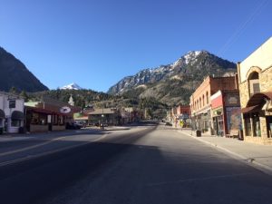
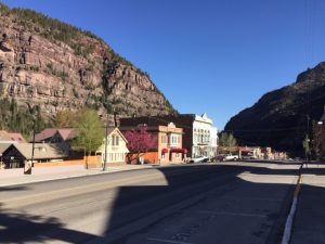
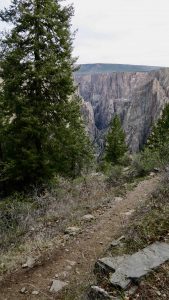
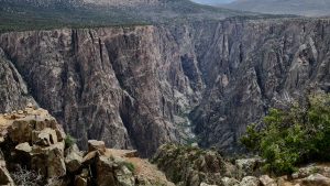
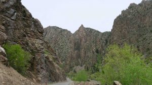
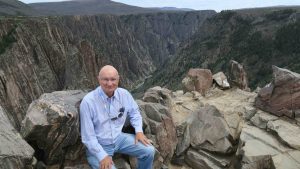
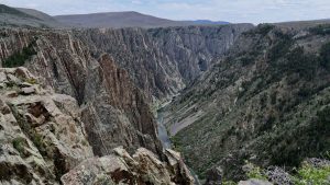
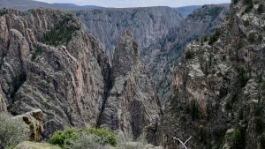
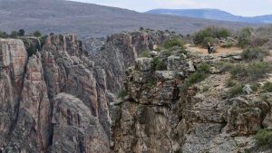
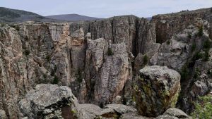
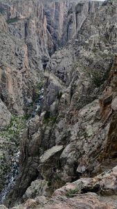
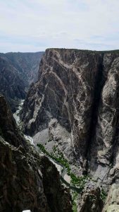
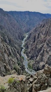
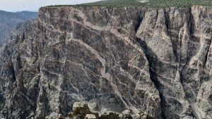
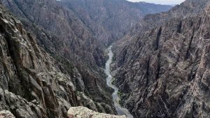
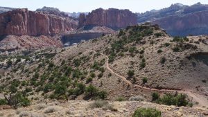
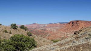
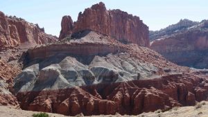
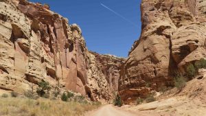
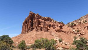
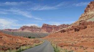
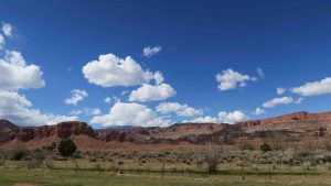
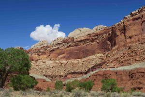
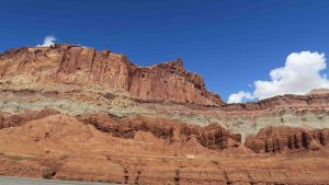
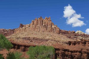
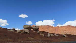
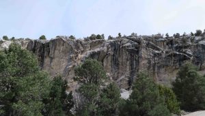
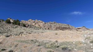
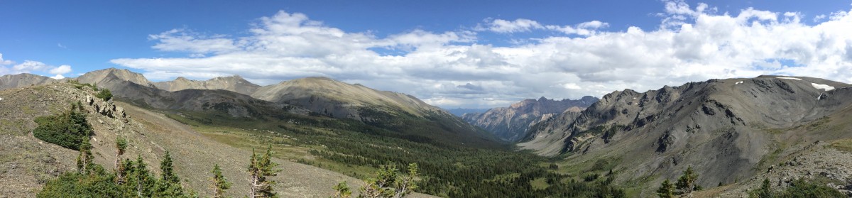
Driving from Montrose to Ouray is boring.  Driving from Ouray to Durango is nail biting.  You go through two mountain passes to an elevation of over 11,000 feet with guard rails at least twice on the trip.  Otherwise, it’s a sheer drop to the canyon floor below.  In most places, the speed limit was 25 mph and at times I thought that a little reckless.  Suffice to say others thought the same since no one was pushing to pass me on the road.  The San Juan Mountains are impressive!

A view of Ouray on the way out via the San Juan Mountains

Horrors!  Pagosa Springs has gone chic!  The nice, quiet, quaint little town with a main drag has gone tourist.  Even the nice, quiet, quaint part of town is now upscale.  There’s an entirely new downtown section, and outside of town all the box stores like Walmart, Home Depot, etc.  None of this was here 2 years ago when I passed through on my way to Mesa Verde.

Downtown Pagosa Springs

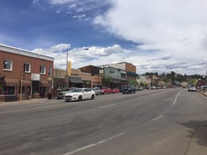
I,at one time, thought I might like to live in Pagosa Springs.  It was not too large, not too small.  It had an interesting downtown and plenty of hiking trails throughout the San Juan Mountains.  I even bought the National Geographic topographic map of the region

Strangest of all in Pagosa Springs is a Cajun restaurant on the old main street appropriately named The Lost Cajun.  The owner of the franchise is originally from Barataria, Louisiana and moved to Colorado to open a single restaurant.  It became so successful he opened several more throughout the state.

The Lost Cajun at Pagosa Springs

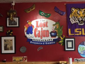
The first thing the waitress does is ask if you would like a sampler of gumbo.  Of course!  There were five and I chose a cup of seafood.  It actually was excellent.  The chef makes them from scratch every day.  

For dessert, I had 3 beignets.  They say on the menu they are like the ones in New Orleans only better.  I disagree.  You cannot beat Cafe Du Monde for beignets.  However, I managed to choke down three of them.  I now have a sugar fix for the next three days.

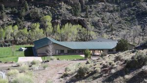
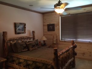
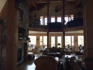
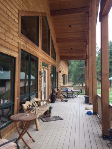
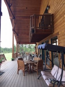
I have stumbled upon the most plush B&B.  It’s called Elk Trace B&B and it is 2 miles outside of downtown Pagosa Springs.  When I was researching a place to stay last year, this one kept popping up on the web.  The photos looked good and I thought for one night, why not splurge.

This place is quite luxurious.  The bedroom is huge with a couch and king size bed.  

The rooms are named. I’m in Bear.

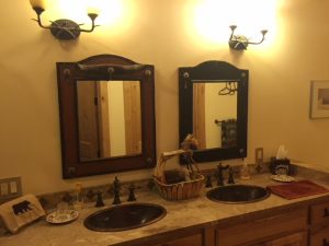
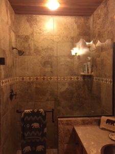
The bathroom is almost as big with double sinks and a massive walk-in shower.  

I can mess up two sinks!

Shower anyone?

The great room is two story with a vaulted ceiling.  

Main Room at Elk Trace Bed & Breakfast

There is a wrap around porch and one couple and I have it all to ourselves.  

Front porch at Elk Trace Bed & Breakfast
Side porch at Elk Trace Bed & Breakfast

There’s even a dog for each of us.  One of uncertain lineage and the other a boxer that reminds me of Nicole’s Lexi, except a male.

It’ll be a long trip into town for dinner tonight but we the quiet of the countryside, I will not mind that.  

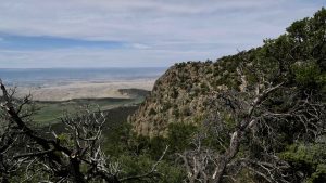
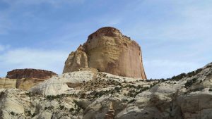
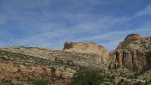
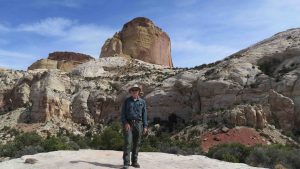
My one disappointment is I will not get to visit Chimney Rock National Monument.  They do not open until May 15th.  I thought I had checked about the availability last year but either I did not or they changed the opening date for the monument (more likely since the NPS has done that several times on this trip).  It’s actually run by the local Ute tribe and I was looking forward to the tour.  

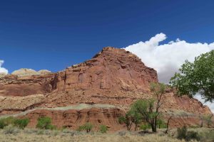
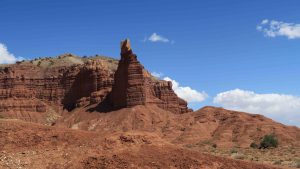
It is the most imposing feature either leaving Pagosa Springs for Durango or entering from Durango.  

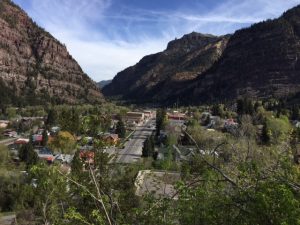
Of course, I looked at real estate prices out here and they are far in excess of Ouray, so Ouray, at the moment, is a bargain in comparison.  

Tomorrow should be a short drive to Great Sand Dunes National Park for 3 nights.

Cross Country Trip – Day 50

8 May 2018

Hooray for Ouray!

Sorry, I couldn’t resist.

Today was a short day for travel and a much needed day of rest.

I decided to go see Ouray.  Jim and Holley (especially Jim) has been raving about Ouray.  If I didn’t know better, I would say this is where these two are going to move next.

It’s a town of around 1000 people and has an old fashioned Main Street.  With the era of suburbia and strip malls, that’s a quaint relic of days gone by and one that I miss.

It’s not tourist season as you might be able to tell.

I remember walking down the Main Street of Morton, Mississippi and being able to pretty much find anything I needed: pharmacy, five & dime, clothing stores, restaurants, movie theater, even the hospital was on Main Street.

Main Street of Ouray

Ouray is a lot like that.  One thing I really enjoyed seeing is Ouray protected its old buildings.  A hotel may not be a hotel any longer but the original from 1890’s is still standing on Main Street.  As often as not, the original purpose of the building is still in effect.

The Beaumont Hotel – on the list of historical places. I think part of it is still a hotel but most of the ground floor is retail space.

Like most small towns, the Main Street is not long.  I walked the length of it and back (bad ankle notwithstanding) and didn’t spend more than 1/2 hour window shopping.  I got there a little after 9 am and absolutely nothing was open.  Most of the stores open at 11 am and that’s in tourist season which it is decidedly not.

Wright’s Opera House (and other sundry things)

I did look at some real estate offerings and most of the prices were in the $250K-450K price range.  There were some bargains but they would require a lot of work.  It seems not only the Wilson’s like Ouray.

Town bench made out of skis!

I was tempted to get in their hot springs (at the entrance to town) but even that looked like it would not open until 11 or later.

I head out tomorrow for Pagosa Springs.  I could actually have driven to Great Sand Dunes National Park in one day and Pagosa Springs takes me further south, but I went through the town two years ago on my last cross country trip and fell in love with the place.  For Jim and Holley, it’s Ouray.  For me, it’s Pagosa Springs.  I’ll be staying one night at Elk Trace Bed & Breakfast just outside of Pagosa Springs but I intend to do some window shopping while in town.  I also want to tour Chimney Rock (every place out here has a chimney rock) which is run by a local tribe.  They allow only two tours a day to the sacred place.

Pagosa Springs reminds me of a hip college town that’s located in the mountains.  I’ll be sure to take some photos of the place so you can fall in love with it also.

After returning to Montrose, I toured the Montrose Botanical Gardens – a work in progress.  They have a very neat area behind the Civic Center that has a great deal of room for expansion.  I was most interested in seeing their native plants and they had an entire section of the garden dedicated to them.

I then called the local jeep dealer, Flowers, and asked if they could dispose of about a pint of diesel fuel.  After the work on the jeep brought on by my stupidity, the water in fuel light came on and I drained it.  I need to get rid of the water and diesel fuel in the container into which I drained it.

The local jeep dealer said sure, bring it over.  I did, they disposed of it, did not charge me, and were super nice.  I particularly enjoyed a sign in the parts department that advertised “free blinker fluid” and commented on it.

From there, it was wash-the-jeep time.  There are two hand held spray car washes next to each other in Montrose.  I pulled into the first one and for the third time this trip debugged the jeep.  Love bugs are terrible in Florida but these are not love bugs.  I think I have found several new insect species on the grill of the jeep.  I intend to name one Glueus maximus.  Even the power spray is not enough to remove them and I have to use a scrubbing pad.

I suspect I’ll have to debug several more times on the trip. Now for a nap.

Cross Country Trip – Day 49

7 May 2019

I think I overdid it with my ankle today.  The distance wasn’t so bad but the up and down was pretty constant.  More Advil tonight.  I must be getting old.  I can’t hike the distances I used to be able to.  I did a total of 5.3 miles today and was tired!

I started out early and was on the Oak Flat Trail by 9:30 am.  A couple started the trail before I got on it and I never did catch them.  I did get a photograph of them resting much further down the trail and very close to the last jumping off point to the bottom of the gorge.  

Oak Flat Trail. I never caught up with them.

I don’t think I’ve walked a steeper trail going downhill than the beginning of the Oak Flat Trail.  I’m not sure of the grade but I suspect it was over 25% in some places.

Oak Flat Trail

Usually, when the descent is that steep (the trail drops 400 feet from the rim) that means it’ll be a bear to get back up.  However, the trail up was more gradual than the descent and did not cause me any problem.

Oak Flat Trail

Every so often you would make a switchback and the vista of the canyon opened up before you.  

After getting back to the top, there was a trail branch for the Upland Trail.  I was hoping for more, different wildflowers but the trail disappointed.  Actually, I think this would have been better named Oak Flat Trail.  It was pretty flat and had a lot of oaks and not much scenery.  You cross the park road twice as you swing back towards the visitor center.

At one point of the Upland Trail, you get a great view of Tomichi Point.  You actually walk the south rim of the canyon and climb to Tomichi Point.  From there it is a quick walk to the visitor center where I had parked the jeep.

Tomichi Point from the Uplands Trail

The Oak Flat Trail is 2 miles and the Upland Trail is 2 miles, so you do the math.

I then drove to Warner Point.  Warner was pivotal in getting Black Canyon designated a national monument back in 1933.  He convinced the town of Montrose to build a road to the canyon which, of course, led to increased tourism.

This isn’t Warner Point but you had to hike there to get there. You got a great view of the valley below where Montrose is located.

Warner Point was his favorite place in the park.  Round trip it is 1 1/3 miles.  This was the part that did my ankle in.  It was down, then up, then down then up, then down and finally up to the point. 

Trail to Warner Point

The view was probably the best overall view of the canyon and it is the deepest part of the canyon at 2700 feet.

View of the canyon from Warner Point

I had company on the last part of the hike.  He seemed as curious about me as I was about him.

Gray Rock Squirrel

The final part of the day was a drive to East Portal.  This is a drive to the bottom of the canyon where the dam is located.  Montrose needed water and the Black Canyon of the Gunnison had it.  The problem was how to get it to Montrose.  In the early 1900’s Abraham Lincoln Fellows and William Torrence were the first people to traverse the river down the canyon in rubber rafts.  They were surveying the canyon for a tunnel to Montrose.  

East Portal – view from the bottom of the canyon looking up. The photo doesn’t do it justice because it really is deeper than it appears.

They found a suitable site for the tunnel and construction of the 5.8 mile Gunnison Diversion Tunnel began in 1905 and dedicated in 1909.  It is still in use today.

The road down, of course, had hairpin turns but more importantly, the grade was 16%.  That’s the steepest grade I think I have ever driven over any length of road. It was pretty much 20 mph in first gear all the way down.

At the end of the road is the dam and tunnel.

Tomorrow I plan to drive over to Ouray, Colorado.  Someone, I can’t remember who, Jim Wilson, insists I see this town of around 1000 people.  It should be an interesting drive.  The town is found a valley surrounded by mountains.  Wilson waxes poetic about this place so I better not be disappointed or he’ll never hear the end of it.

Cross Country Trip – Day 48

6 May 2018

It was a fast drive from Capitol Reef to Black Canyon of the Gunnison outside of Montrose, Colorado – about 5 hours.  I stopped in Grand Junction at the REI store.  

Somewhere along the trip, I lost a set of tent pegs for the REI 8 person tent.  They were substantial metal pegs and I needed to replace them.  I actually put the tent up at Craters of the Moon with spare pegs I use for the smaller tents but I could tell they would not be good for the bigger tent in any wind.

The REI store opened at 11 am and I pulled into the parking lot at 10:50 am.  The tent pegs were $1 each and I bought 10.  I probably will not put up the big tent but one more time – at Theodore Roosevelt National Park.

I pulled into Black Canyon of the Gunnison around 1:35 pm and immediately hit the visitor center.  The information ranger at the desk suggested some easy day hikes for me tomorrow and I decided to drive the length of the South Rim Road (7 miles) and pull into all the overlooks.   There are 10 along the length of the road.

The first overlook was Pulpit Rock.  There is a projection of rocks out into the canyon and you can walk onto the “pulpit”. 

This is a good view of the “pulpit”. It’s amazing how close to the rim of the canyon you can walk without any guard rails. There is one stretch that connects the pulpit to the land mass and one woman refused to cross it, it was so scary.

This is a pretty amazing canyon.  One expert, George Wallace R. Hansen said “no other North American canyon combines the depth, narrowness, sheerness, and somber countenance of Black Canyon.” 

The reverend is in the pulpit – preaching global warming and evolution.

Unfortunately, photography does not do it justice.  You need stereoscopic vision to appreciate the depth and sheerness of the canyon.  As I walked to the edge, I would get a tingling in my feet and a tinge of vertigo.  I do that when I’m around high places, but I quickly become accustomed to the feeling.  Every time I walked to an observation point, the feeling re-occurred.

It was here I decided I had died and gone to heaven.  I photographed more wildflowers in bloom in 1 hour here in the park than I did the last three days in Capitol Reef.

You see the Gunnison River cutting through the Canyon. The river falls an average of 96 feet per mile and in one place drops 480 feet in a two mile stretch.

Next observation point is Cross Fissures.  You get a good view of some giant splits in the rock from this point.  It’s an easy 375 yard walk to the fissures.  Each location told you how many yards you had to walk to get to the observation point which was handy for people who were worried about the distance.

Cross Fissures

From Cross Fissures, it was a short drive to Rock Point.  

Although the photo was taken from Rock Point, you can see people at Cross Fissures observation.

From there, another short drive to Devil’s Lookout, although I don’t know what the devil was looking out for.  

Devil’s Lookout

Next up was Chasm View, another short drive.  You get an idea how deep the canyon can be. 

Chasm View

One of the more spectacular views was Painted Wall. A sheer cliff was patterned with pegmatite. This molten rock squeezed into fissures in the canyon wall and solidified to form the bands of minerals of mica, feldspar, quartz and garnet (go FSU).

The Painted Wall with pegmatite dykes.

Next up was Cedar Point.   Yes, there are a lot of Utah Junipers (not true cedars) on the point but you don’t go to look at the cedars.

Cedar Point. These were very low rocks that intend to keep you from falling over the edge.

Dragon Point was pretty spectacular as you can see below.  It had a great view of the Painted Wall.

Dragon Point offered more views of the Painted Wall

Sunset Point probably offered the best view of the canyon – its sheer size and depth.  

This is probably the best overall view of the canyon.

The turn around was High Point.  First thing tomorrow is the 2 mile Oak Flat Trail which descends 400 feet into the canyon.  I ‘ll also try the 1 1/3 mile to Walker Point from where you will see the canyon at its deepest – 2700 feet.

I also intend to hike the Rock Trip and Take Flat Trail during this trip.  I’ll see how I progress as to whether I get them all done.  

After hiking, I’ll drive the East Portal road which drops you down to the canyon floor.  It has a 16% incline that your vehicle must be able to manage.

Just walking to the observation points today, I clocked 2.3 miles.  Remember, if it is 100 yards to a point, it’s 100 yards back. All said and done, it was 4026 yards of hiking.

Tonight is wash night at the Quality Inn and Suites (just OK) and a late dinner.  

Cross Country Trip – Day 47

5 May 2018

My ankle felt OK this morning so I opted to forego the drive to Grand Staircase – Escalante.  It would have been 2 1/2 hour drive there and 2 1/2 hours back and I’ll be doing enough driving tomorrow morning.  I would like to see it and also eventually Monument Valley but it’ll have to wait for another trip.

Some of you know my college French teacher (and good friend) Jack Brown lives on the big island of Hawaii.  He lives off the grid near the town of Pahoa.  That’s were the volcano Kilauea erupted yesterday and then the 6.9 quake.  Pahoa is in direct line of the lava flow.  I sent an email and then eventually called.  He emailed me back he was on vacation in the Philippines and was safe and as far as he knew at the moment his home was OK.  

With that established, I had breakfast at the retreat – buffet style – just OK and loaded up for the trip to Capitol Reef for some more hiking.

I retraced my steps to Capitol Gorge today.  I confess my first trip down to the gorge yesterday I got sidetracked with wildflowers.  I was looking down and not up.  Today, I looked up.  I’m not sure there is a more spectacular drive in all the U.S.  I can’t believe I didn’t see this yesterday.

In any case, I decided to hike to the Golden Throne formation.  The hike is labeled as strenuous and is 2 miles – up – one way.  The elevation climb at 730 feet is not terrible but it is a constant climb.  For the most part, the trail is pretty well marked and after an initial struggle up a steep slope, it levels out for a while.  

Trail to Golden Throne at Capitol Gorge.

I think you hike around three or four canyons to get to the Golden Throne.  You round the corner of one canyon, go all the way back to its beginning and then hike around another canyon, and repeat.

One sight startled me.  A lone pine tree on the face of a cliff.

My definition of tenacity in a photograph. Hang in there!

The final ascent is pretty steep but once you get there, you have a great view of the Golden Throne. 

Golden Throne


However, at first glance, it looks nothing like a throne.  Not far away is another feature that to me looked more like a throne.  It looks like it has two arm rests.  It is also a nice golden color.

This looks more like a throne to me – see the arm rests?

The actual Golden Throne is more massive and if you look carefully, there is a large horizontal and vertical piece missing from the formation that gives the impression of a “seat”.  

Me and the Throne

This was a great hike.  My ankle made it OK and I was able to complete the hike in a little over 2 hours.  I had lunch at the end of the trail looking at the Golden Throne.  I’m more comfortable in trying to do a “strenuous” hike.  I’ve done several this trip (2 at Capitol Reef) and have faired well.  I do take a lot of rest breaks, though.

I met several people along the trail and they were all very nice.  There were two guys coming up as I was leaving and they were in some deep philosophical discussion.   It seemed like one was a professor and the other was a student.  Neither stopped talking the entire hike.  They passed me going down the trail after they reached the top and they were still talking.  I doubt very seriously they saw anything of the scenery or the vistas along the trail they were so deep in conversation.  

A little political incorrectness here. This rock struck me as a creature running over the rocks and as I looked closer, it had a different colored surface on the top. It then struck me that it looked like Donald Trump’s hair and even his head from behind.
The parking lot at Capitol Gorge after the initial climb in the first canyon.

As I returned towards the Visitor Center, I stopped at the historic Gifford House (museum and store) and purchased one of their famous pies – cherry if you please – for $6.  I think that will be part of my desert tonight.  Everyone was eating them all around the picnic tables near the house.  They must be good.  

I was going to hike a little along Fremont Creek but as I started on the trail, it was very uninteresting, so I opted to drive to the other end of the park to say I had been to both entrances.  

Tomorrow I have a five hour drive to Montrose, Colorado where I will set up operations at the Quality Inn and Suites for three nights and from there explore the Black Canyon of the Gunnison.  

Cross Country Trip – Day 46

4 May 2018

What a great day!  The weather was perfect, the sky was blue, and my ankle didn’t bother me too much.  I also think I might have a new “favorite” national park!

As I mentioned yesterday, I ultimately decided to hike the Chimney Loop.  Fortunately, the loop was 3.8 miles round trip, not one way.  I started the hike at 9:09 am and finished 2 hours and 23 minutes later.  This is a spectacular hike.  

Chimney Rock Loop Trail

All Trails recommended that when I come to the junction of Spring Trail and the Loop, to hike the loop counterclockwise.  That’s the steepest ascent and I wanted to tackle that first thing.  The trail is rated as strenuous but I didn’t have too much trouble.

I did run into an Australian couple and the guy kept wanting to give me lessons in geology and show me his gps.  He is a retired electrical engineer.  I think his wife mostly humored him. He really just wanted was to rest before continuing to climb.  Let it be known that they passed me on the trail but later I passed them and finished the trail well ahead of them.  

Australian Couple atop the Ridge

This loop is rated as one of the best hikes in the park and I cannot help but agree.  The top of the ridge lets you look down on The Chimney, 300 feet above the floor so the trail at the top was at least 350 or 400 feet.  

Me at eye level with The Chimney.

There are two gymnosperms dominant here: the two needle Piñon Pine (Pinus edulis) and the Utah Juniper (Juniperus osteosperma).  Both leave beautiful driftwood-like shapes on the landscape.  Most of what I saw as dead was Utah Juniper.

Utah Juniper

At the top of the ridge, I could look down on two places I visited yesterday: Panorama Point and Gooseneck.  

View from atop the Chimney Rock Loop.

I also got a different view of Fluted Walls.

Chimney Rock Loop view of Fluted Walls

After I finished, my gps said I traveled 3.85 miles.  The Australian couple said 5.75 miles and 640 feet elevation gain.  I think they were using kilometers instead of feet and miles.

Next on the agenda was to drive the Scenic Drive.  It’s a ten mile road that ends in Capitol Gorge.  The scenery here is amazing.You drive down a canyon with sheer walls to either side of you and constant warnings to not be in that location during flash floods.  

Capitol Gorge

The place was packed and even when it changed to dirt roads, the traffic was pretty heavy.  Some of the views are worth a mention.

One of the formations is known as Egyptian Temple.  What a strange rock formation!

Egyptian Temple

As I drove back the 10 miles to US 24, you got a magnificent panoramic view of Capitol Reef National Park.

As I say, in for a penny, in for a pound,  I headed to Hickman’s Bridge.  This is a 1.9 mile round trip to a natural bridge.  

One part of the trail affords the best view of Capitol Dome.  The white sandstone is known as Navajo Sandstone and it gives the park its name.

It’s all uphill at first and you gain 600 feet in elevation as you hike up.

Trail to Hickman Bridge

At mile 0.9, you come to the bridge.  It’s pretty amazing and you can walk under the span.  This is the first time I’ve known the public to be allowed to walk under the span of a natural bridge.  As a matter of fact, the loop requires you to walk under the span.

Hickman Bridge

My last stop of the day was at The Petroglyphs.  How anyone got up on the side of that cliff to do these is beyond me but they were impressive.  I suspect they were about 60 feet off the ground and each petroglyph was probably at least a foot in height.

Petroglyph

They were also some of the most well formed ones I’ve seen.  

I ended my day with a shower and an enchilada dinner at a local Mexican Restaurant – Le Cueva.  

I’m up in the air about tomorrow.  I could do some more hiking but I can tell my ankle is sore from the last hike.  I did a total of around 5.85 miles today.  Some of the Hickman Bridge trail was very rough and rocky and it took its toll.

An option is to drive 185 miles south of here to Grand Staircase-Escalante National Monument.  This is one of those that the Trump administration is cutting back the size – along with Mules Ears.  I’ll let the ankle decide tomorrow.  

Cross Country Trip – Day 45

3 May 2018

Breakfast at Hidden Canyon was at 8 am.  The cook made my breakfast to order and then sat down and had a long conversation with me about the park, the retreat, people in the park service, and every other topic we could think of.  What a nice person! I was the only person at the retreat last night.  Even so, the cook prepared me a full breakfast – eggs, beef sausage, toast, home made banana bread with chocolate chips.

Kudos to my jeep.  I was a little leery about a 7 hour drive today and wondered if I would have some kind of engine trouble.  Nary a peep.  The jeep performed like a champ so Sahara Motors did their job well.

I pulled into Torrey, Utah around 2:30 pm.  My GPS led me past my motel for the next three nights, Capitol Reef Resort.  It does that sometime even though I typed in a street address.   The resort is a pretty large place where they even have tepees in which you may stay.  The photos of the insides of the tepees show a luxurious interior.  Glorified tent camping.  My room is a little more mundane – typical motel room but the view out the window is worth the price of the motel.

View from my room at Capitol Reef Resort

Instead of checking in immediately, I decided to head to the visitor center of Capitol Reef  National Park, some 6 miles from the motel.  The scenery leading into Torrey was pretty nice but when you enter the park, you are blown away.

Have you ever thought what it would be like to be able to drive through the Grand Canyon?  The drive to the visitor center is pretty much like that.  Sheer cliff walls rising hundreds of feet over you with amazingly vivid colors of reds, oranges, whites, and purple.  

The stop at the visitor center allowed you to view two beautiful formations.  One is named The Castle and I suppose it could look something like one.  

The Castle

The other is a massive rock wall hundreds of feet high.

Capitol Reef National Park

Backtracking to the motel, I pulled off at Panorama Point where you got a great vista of the park.

View from Panorama Point

Also, across the road from Panorama Point is an area known as Fluted Wall.  I assume the parts at the base of the cliffs is where it gets its name.

Fluted Walls

From Panorama Point, you can take a side road to Gooseneck – a deep canyon overlook where a creek has eroded 800 feet down into the canyon.

View from Gooseneck

Next up was The Chimney.  There is a loop trail I may try while here, but it is 7.6 miles.  I’ll have to think about that.

The Chimney

Another striking feature was Twin Rocks.  They are much larger than they seem in the photo and you wonder how long they’ll be balanced there.  

Twin Rocks

There are a couple of scenic drives I would like to take tomorrow and maybe do a few short hikes.  The following day I may attempt The Chimney loop or some other longer trail.  The section of the park I am in is called Fruita (there was a settlement here at one time with lots of fruit trees).  They have a campground and several areas of interest.  The northern section of the park is called the Cathedral Section and the southern section is called Muley Twist.  

The lower section of the park abuts The Grand Staircase-Escalante National Monument.  I hope that I might get down for a drive through to that area, maybe tomorrow.

In 2014, Nancy, Michel and I flew over Capitol Reef with a Tauck Tour.  Flying over the park certainly gives you an interesting perspective but driving through the park is spectacular.  Every where you look is another beautiful rock formation.

Cross Country Trip – Day 44

Hallelujah!  The jeep was ready this morning.  They sent a car to the motel to pick me up at 9:30 am and I was on the road to Great Basin at 10.  The guy they sent was super nice.  He even loaded the luggage in the jeep for me while I settled the bill.  I said hello to Carl and Heather who I had pestered for two days and thanked them profusely.

The total bill was $388.14. I was stunned.  They drained the fuel/water separator, drained the fuel tank, replaced two fuel filters, ran a fuel pump cycle to clear the lines, added new fuel and ran the engine to check every was good.  If I had this done in Fort Lauderdale, I suspect it would have run significantly over $1000.

I had no sooner turned on the road to Great Basin when the “water in fuel” light came on, dinged 5 times and then went quiet.  I figured I had time to worry about that later.  When I pulled into Great Basin, I pulled out the owner’s manual and they said to drain it immediately.

I climbed under the jeep, loosened the screw to the drain, started the engine and drained the water.  Unfortunately, a lot more fuel came out with it.  I’m afraid I splashed a little on the pavement at Great Basin.  Most got caught in the receptacle I used but there was a little overflow.

Since I’ve done that, everything has run smoothly with the jeep.  I climbed two passes on the way to Great Basin and did 70 mph when it was the speed limit.  I feel more confident that everything is ship shape but I’ll find out tomorrow for sure when I head to Capitol Reef National Park outside of Torrey, Utah, a six hour drive.

My reservation for a 10 am Lehman Cave tour was yesterday but I lucked out and they had an opening for 1 pm.  I lunched in their cafe on site and made the 1 pm tour.


Lehman Cave – colors are due to minerals in the water which formed the cave.

At least two people have told me Lehman is their favorite cave. I now see why.  The formations are spectacular and you are very close to the formations, unlike some caves where you view them at a distance.  The interpretive ranger, although an astronomer, gave an excellent tour with much of the history of the cave.  

Ranger Annie in Lehman Cave

In the late 1800’s people would dress in fancy dress and then end up crawling through spaces on their hands and knees.  One room, called the Inscription Room, had the ceiling of the cave filled with people initials made with candle soot.  I must have had an ancestor do it since I found F.S. on the ceiling.  

An ancestor of mine? These are from candle soot around 1890.


The tour was about 90 minutes and it was one of the best tours I’ve had on any trip.  The cave is a must see if you are into caves.  I was reluctant at first since my schedule had been thrown out the window for this park but I’m glad I did the cave tour.

Lehman Cave

I did a short drive in Great Basin that led to two campgrounds and a trailhead.  It was pretty scenic and one spot in particular was called Grey Cliffs.

Grey Cliffs in Great Basin National Park

I stopped the jeep on the way to the trailhead to take a photo of a wildflower and as soon as I got out, I heard turkeys calling.  I was about to get back into the jeep after taking the photograph and I had a curious visitor.

Yellow Bellied Marmont

I pulled into Hidden Canyon Retreat around 4:30 pm.  This is an amazing place.  It’s much larger than it seems (384 acres) and very modern.  Chrissy checked me in, I purchased two individual pepperoni pizzas and headed to the room.  It’s motel style but the accommodations are very plush.  

Hidden Canyon Retreat

Breakfast is individually prepared for you and I’m scheduled for 8 am tomorrow.  After that, back on the road.  


Hidden Canyon

Cross Country Trip – Day 43

1 May 2018

They started working on my car after noon today.  I hung out in the lobby/breakfast room of La Quinta Inn & Suites listening to podcasts, wishing my sister-in-law Tanis an early birthday, letting my bro know about the jeep and talking with my cousin Jimmie in Greensboro.

It was an interesting way to spend 4 hours.  The phone calls were the best part. I have to say Sahara Motors is bending over backwards to help me out with my problem.  I called at 3:3o pm and asked if I should get a room in town again for the night and the manager suggested it would be a good idea.  Sahara Service Department will probably finish with the jeep right around 5 pm and that’s the closing time of the service department.  The hang up is getting all the electronic gadgets back on line – and getting me to the jeep.  I wonder if they have taxis here? I was told they want to let it sit overnight and then do a test drive tomorrow.  The manager suggested I call them around 9:30 tomorrow morning.

I called Hidden Canyon and let them  know I would be in Ely another night.  They are also very accommodating.  She said no problem.  I told her if she needed to rent the room for the third night go ahead but I really did want to spend one night at the retreat.  She said it would be vacant.  I also said charge me the minimum for cancellation if she needed to but she doesn’t seem to be so inclined.  I certainly don’t mind, but that’s how nice people are around here.

I checked the front desk at La Quinta and they put me in the room next to the one I had last night.  Again, nicety seems to be a requirement to live in Ely, Nevada.  Plus, they offer free cookies later this afternoon.

Last night I walked next door to the local grocery store and had a pasta salad and fried chicken.  Publix’ is better but this hit the spot.  I’ll probably do the same since the only walking distance place is Mickey D’s.

This morning we had an interesting weather phenomenon.  It snowed and hailed at the same time.  It lasted for about 30 minutes but there was no accumulation since the temperature was above freezing (barely).  Several of the workers commented on how there is no summer in Ely – only winter.

When I think about it, this has probably been good for me to rest my ankle and rest myself.  The jeep screw-up on my part was bad but the down time has been nice.

I was scheduled for a tour of Lehman Caves at Great Basin at 10 pm tomorrow but looks like I’ll miss that.  I may try to reschedule since this does not seem to be their busy season.  I suspect they had a little accumulation at Great Basin since it is so high in elevation.

One interesting feature of this motel is they are very pet friendly.  I’ve seen quite a menagerie since I’ve been here.

It’ll be another early night.  I went to bed last night at 8:30 pm and waked up at 4:30 am.  Plenty of sleep.  Hope so tonight!


Update

1 May 2018

The first towing company arranged by AAA did not come through.  Instead, I called the recommended towing company by Sahara Motors and they showed up 15 minutes later.  The young man worked quickly.  The biggest problem was getting the jeep in neutral without starting the engine.  That’s impossible.

Instead, I called Jeep Assistance and they walked us through how to put the vehicle in neutral without starting up the jeep.  You have to lift the center console of the jeep, pull out a panel, pull a string attached to a lever and shift a lock to the left.  Unbelievably complicated!

He quickly got the jeep loaded and was nice enough to drive me to my motel.  He also helped me unload my luggage and bags from the jeep and took the jeep to Sahara Motors.  I tipped him extravagantly for his efforts.  He really went above and beyond the necessary.

I called Carl in the service department this morning.  He thinks he will be able to get to the jeep and maybe have it ready by noon today.  I talked to him about the recommendations for what to do on the internet and he had apparently already checked what should be the protocol.

I’ve pestered Carl for the last two days.  He’s always been courteous, willing to listen, and willing to work with me in any way he can.  I have to admit I’ve had nothing but positive experiences with everyone in Ely, Nevada.  Even the parts guy at NAPA helped out with the loading of the jeep on the tow truck.

The real question remains if there was any damage to the jeep.  There are some horror stories on the internet about my situation so I apparently am not the only idiot on the planet with this problem.  I’ll perhaps know something more around noon.

My plan is to continue my reservations at Hidden Canyon Retreat and do the Lehman Caves tour at Great Basin National Park tomorrow.  Again, keep your fingers crossed for me!