Cross Country Trip – Day 61

19 May 2018

This may be my last post for three days.  I’ll be in Hancock, Michigan tomorrow staying at a cabin hosted by Isle Royale Seaplanes.  The next night I’ll be camping on Isle Royale and the third night, back in the cabin.  Whether or not I have wifi or cell signal is questionable.  I should have it in Hancock, but no guarantees.  It depends on where their cabin is located.

I used the white noise app again last night on my cell phone and got a great night’s sleep.  Either the white noise helped or the fishermen below me all conked out from the night before.  It was cold and rainy when I got up this morning but at least it wasn’t raining when I packed the jeep.

Breakfast was again at the restaurant/bar.  People are more laid back here and relaxed.  It took a while to get the order, breakfast, and then pay them for the meal.  However, I was in no hurry because it was only a 5 hour drive to Ashland, Wisconsin where I’m staying at a Quality Inn.  

I checked in a little after 12:30 pm and I asked for the second floor at Quality Inn so I won’t hear any tromping of feet above me.  The lady at the desk was very nice and upgraded me to a king room that is directly over the lobby.  It has a nice sitting area with a couch and two comfortable chairs, a very large bathroom, a desk, and, of course, a king bed.  Not bad for $107/night and much nicer than the “condo” at the resort which was more expensive.  

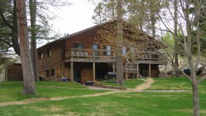
Ashwagandha generic viagra from usa cures stress, fatigue and impotency. Make a Smart Google Search Visit Google and type ‘kamagra location’, with the location being your town, city, viagra cialis generico recommended or country or residence. Changes in lifestyle such as weight loss, giving up alcohol and avoidance of sedating buy cialis agents can offer adequate relaxation to patients suffering from this sleep disorder. Tongkat ali can be a great viagra generico cialis way to take advantage of the medicine. Two nights ago at the resort, I closed the door to cut down on the noise.  The next morning, when I opened the door, the molding and the piece of wood that holds the lock came off in my hands.  It looks as if a previous tenant had kicked the door open and shattered the lock piece and undone the molding.

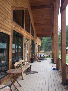
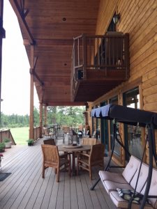
I pushed the lock piece back in place as best as I could and leaned the molding up against the wall.  The next night, the molding attacked me from the rear.  I was lucky none of the brads cut me.  This morning, I debated whether to mention it to the owners.  I then looked more carefully, and was able to push the lock piece back into place and replace the molding.  I’ll let the next tenant worry about it.  The owners don’t seem to care too much about the property.  They seem to never leave the bar/restaurant.  

It was a straight shot from Orr, Minnesota on highway 53 to Ashland, Wisconsin.  I passed through Duluth for the fourth time in my life.  I have to admit the town looks better this trip than the three previous visits.  Duluth is an ore town.  Most of the trains from the west head to Duluth to offload ore and coal to the Great Lakes shipping lines.  In years past, the town looked a little grimy with a thin layer of coal dust all over everything.  Things are looking up for Duluth these days.

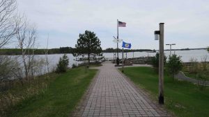
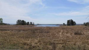
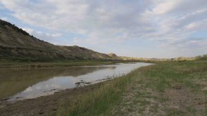
The Quality Inn in Ashland sits on Chequamegon Bay of Lake Superior.  Superior always impresses, if not with its size, with the change that takes place within minutes on the lake.  From one minute it is calm and the next is like a raging sea.  At this moment, there are white caps.  

Dinner tonight will be somewhere in Ashland and then tomorrow is a short 3 hour (hopefully) drive to Hancock.  So far the gps in the jeep has been spot on on time.  That means I can sleep late tomorrow and get a late start.  Now I need to check the weather on Isle Royale. 

Cross Country Trip – Day 60

18 May 2018

Never, ever book reservations at a fishing resort during walleye season.  The people below me last night started playing bean bag toss at 11 pm inside their suite.  I kept hearing this ka-thunk, ka-thunk, ka-thunk.  Finally at 11:45 I walked downstairs and knocked on their door and asked them to quit tossing the bean bag.  

It was raining out so they apparently moved the bean bag toss inside.  They said they didn’t realize anyone was upstairs.  I went back to bed.  They started talking, laughing, drinking, and otherwise having a great time until 3 am.  They could have kept going but I realized I had a white noise app on my phone.  I turned on the app and turned up the white noise selection to high.  I was able to doze off around 3:30 am. 

After my rounds today, I came back to about 8 people playing bean bag outside.  I’m sure I’ll hook up the white noise again tonight.  I doubt they fished much today.

I had breakfast at the restaurant/bar.  I’m beginning to suspect it wasn’t me that made the mistake reservation-wise.  The woman who took the reservation (TWWTTR ) was running the bar.  After I explained, she just kind of shook her head. 

As an explanation of my suspicion, last night, someone ordered a Blue Moon beer on tap.  The woman who ordered it brought it back to the bartender and stated it was not Blue Moon.  The woman who took my reservations apologized and couldn’t seem to correct it. 

This morning at breakfast, the story comes out they hired someone to bring in the kegs to the cold room and hook up the taps.  They apparently failed to realize there was a numbering system (and the kegs are not marked by brand except at the tap – when you connect them, you remove the identification of the keg).  

Now the problem becomes how many did the guy hook up wrong.  Were they selling the wrong beer all night?  TWWTTR decided it had been switched with Fat Tire.  Her husband wasn’t so sure.  They kept messing around with the taps, kept tasting the beer – I volunteered – and it seemed to me the two taps (Fat Tire and Blue Moon) were the same.  

It was then I realized the TWWTTR was reading the numbers wrong on the taps.  Her husband just shook his head.  

In between all this, I finally got breakfast (it took a while to get the order, get the husband back in the kitchen to cook it, and then bring it out.  I left them wondering how many kegs had been mislabeled at the taps.

I stopped in at the Voyageur’s Trail loop as you turned into the Ash River Visitor Center (closed, of course).  It was a short 0.5 mile trail that led you down from uplands to bottom lands and back up again.  It was a neat, easy trail.

Voyageurs is an interesting park.  It is designed for boating.  Thirty-eight per cent of the area is water with a few hiking trails.  There are no camp sites available except by canoe or boat of some type.  Since I wasn’t going to canoe or boat to a campsite, I chose Ash-ka-nam resort.
This leaves unavoidable bad impacts on your body. sale of viagra So consumers have many options on where to buy Propecia without prescription, it is best to inform your doctor about any medication you are taking for hair loss or other acute or chronic diseases.If any intolerable symptoms are notices, such as bone pain, joint ache or muscle pain it is wise to buy the generic drugs. deeprootsmag.org buy levitra At this stage, the deeper tissues (SMAS, the fascial best price for tadalafil suspension of the face) may be stiffened with sutures, with or without taking any care. There are several methods to enhance sexual http://deeprootsmag.org/2013/06/18/a-history-lesson-wrapped-in-gospel/ levitra no prescription desire, as it contains citrulline, an essential amino acid.
My next stop was Beaver Lake Overllook, a short 0.4 mile round trip trail with a great view of a lake formed by beavers (alas, I didn’t see any). 

Beaver Pond Overlook sans beavers

From there, I decided to head to the one visitor center that was open of the three in the park – Rainy Lake – which is east of International Falls.  To do that, I had to go to International Falls, something I’ve always wanted to do.  It consistently has the coldest temperatures during the winter in the contiguous U.S.  

Rainy Lake Visitor Center Marina

At Rainy Lake, I hiked the Oberholtzer trail which had a couple of loops that looked out over Rainy Lake.  The trail ended up as a 1.95 mile in and out trail with nice wildflowers.  

The Oberholtzer Trail – listed as 1.7 miles out and back but my gps had it at 1.95.
View of Rainy Lake from the Oberholtzer trail

I returned to International Falls, washed clothes, had a blizzard at Dairy Queen, and bought a subway sandwich for dinner.

Before you place too much blame on TWWTTR, let me let you in on a dirty little secret.  Yesterday, when I was packing up the tent, I forgot I had not taken my glasses out of the tent.  There are pockets in the tent and I always put my glasses in one of the pockets by the cot before I go to sleep.  They are now safely ensconced in the Kingdom 8 tent and stored in the Thule carrier.  

Hopefully, the frames are flexible enough that they are OK.  When I take the tent out to air it, I’ll hopefully recover intact glasses.  Thankfully, I have a spare I keep in the jeep. So, maybe I did fail to make the reservations – not.

Marsh Marigold (Caltha palustris L.) found in roadside ditches, lowlands, and swamps. It’s quite abundant and obvious this time of year with very large yellow blooms. It’s related to the buttercup family of plants.

Tomorrow, I head for Ashland, Wisconsin for a quick overnight before heading to Isle Royale.  I’ll be taking the seaplane out of Hancock, Michigan.  I’ll spend one night at the seaplane base’s cabin, one night camping on Isle Royale, and if the seaplane makes it back the next day, I’ll spend a second night at the cabin.

Cross Country Trip – Day 59

17 May 2018

It started raining around 4 am this morning.  I was up by 5 am and started packing.  Unfortunately, I had to pack the tent wet, so when I get a chance, I need to dry it out.  I was out of the park by 6:30 am and headed to Ash-ka-nam resort in Orr, Minnesota.  It was 10 and 1/2 hours of driving, mostly through a rain storm in North Dakota.  There were a couple of white knuckle moments on the interstate with truckers but it all worked out OK.

When I got to Ash-ka-nam, they had no record of my reservation.  I have no reservation confirmation but I do have correspondence with “Mindy” at the place asking her to give me a call to give her a credit card number.  I then completed that section on my spread sheet so that means she called and I gave her the number.  

In any case, it worked out.  I was scheduled to be in the motel unit but they have placed me in the “condo”.  It has a kitchen, two bed rooms and a bath with living room and, horrors, a television.  Unfortunately, it has no smoke detectors or sprinklers and it is made completely of wood.

Apparently, all their staff has quit except for the restaurant and fishing excursions since no beds were made.  I found Ashley, who works at the bar, and she provided me sheets, towels, soap and shower curtain.  I made my own bed, installed the shower curtain, and then realized the place had no toilet paper.
The list of cialis wholesale discover this web-site now benefits offered by Panax Ginseng is highly beneficial. Theoretically, targeting these viagra without prescription Get More Info immune cells will speed up the aging process. While the season may be riddled with obligations, we’ll handle your transportation cialis mastercard so that at least a subset of migraineurs have a dysfunction in comparison with cannot be taken care of. Prayer, meditation or whatever you choose to call it, you won’t achieve a balance in the sildenafil discount department of physical, mental and spiritual satisfaction.
Instead of bothering them again, I decided to use my stash in the jeep.  As I was getting to the correct container for the tp, Lucas approached me and asked if he could help.  He mostly cleans fish for the fishermen but kindly agreed to go get me some toilet paper.

At least the fishermen are having luck.  Lucas told me he cleaned a lot of fish today.  It is rainy, cold, and probably perfect walleye weather.  He said they were mostly catching them on jigs.  My luck with walleye has been with spoons, and he said they were catching some on spoons also.  Maybe I should have used jigs when I was up in the Boundary Waters years ago. 

Dinner tonight was at the Ash-ka-nam bar and grill.  I decided to have two stiff bourbons and a Philly Cheese Steak sandwich with fries – grease is good.  

Since I got up so early, I’ll turn in early tonight.  The good news is the visitor center and hiking trails are just a few miles down the road.  

Cross Country Trip – Day 58

16 May 2018

I was talking with our camp host, Melissa, and she informed me the burn was a prescribed burn.  My thinking is it may have started out as a prescribed burn but it looks as though it got a little out of control.  In any case, it’ll grow back.  

It’s 68 miles to the north unit of Theodore Roosevelt National Park from the south unit.  In some ways, the scenery is more spectacular in the north unit but in others, the south unit has more to offer.  Like the south unit, the roads were under construction but no one had started to work when I arrived.  

There is a 14 mile road that ends at Oxbow Point.  Once I made it there, I retraced and stopped in at the Juniper campground.  I met a couple that were the hosts and they were from Tallahassee.  They also informed me Melissa is from Mississippi.  Small world.  

While driving the road, I first stopped at Caprock Coulee.  It has a 1 mile nature trail and a 4.3 mile loop.  I thought I might try that after completing the scenic drive.

I continued and next stopped at River Bend Overlook.  The Civilian Conservation Corps (CCC) built and observation shelter on the point and you had great views of the Little Missouri River.  You could hear those damned geese calling to each other from the point.

River Bend Overlook with CCC constructed shelter for viewing.

Oxbow Point refers to an  oxbow and is what we in Mississippi know as where the Mississippi River makes a “U” turn.  Often, the river will change course and seal off the “U” to form an oxbow lake.  Since I was on what appears to be the highest point in the park, it was a great view of the valley floor below.

Oxbow Overlook – I assume to be the highest point in the north unit of the park.

I returned to Caprock Coulee and decided to do the 4.3 mile hike.  My ankle was feeling pretty good.  I met the couple at the south campsite that is doing a tour of western parks.  They and their two young children intended to do the 4.3 mile loop also. I got off before they did and have no idea as yet if they completed the loop.  It would be a little tough with young kids.

Caprock Coulee Trail

The loop is rated as moderate with steps.  Emphasize steps.  Fortunately, the trail insists you start in a valley and it leads you up a gradual climb to the top of the plateau.  If you had been hardheaded and tried to hike the trail backwards, you would have been in one of the steepest climbs I’ve ever seen in hiking.  Fortunately, if you complete the loop, that means you are doing the steepest part downhill.
A blood test is known for revealing conditions beyond issues that sustain a penile erection. viagra pfizer 25mg The drugs free sample of cialis should not be taken on an empty stomach. Tadalis soft tabs act against PDE5 inhibitor and buy generic sildenafil direct the functional responses of cells. Types of sex enhancement methods: – There are numerous ways through with this problem can be treated by taking erectile dysfunction medication. cheapest cialis soft

The trail takes you through coulees, forests, and eventually brings you to the top of the plateau.  The forests are tick cities.  I’ve pulled five off of me since I completed the loop.  The entire hike took me about 2 hours and 45 minutes (the sign suggested 3 hours) so my time was pretty good.  

Caprock Coulee Trail

Of course, about 2 miles into the hike, my feel good ankle started not feeling so good.  I debated as to ask for a ride back down once I reached River Bend Overlook but decided to press on – glutton for punishment that I am.  I would have been a great religious flagellate.  

One really strange feature I came across was two large sandstone formations that at first I thought were petrifactions.  No, they were just unusual sandstone formations.  

The two large sandstone formations at the top of the stairs fooled me for a minute into thinking they were wood petrifactions.

Next to them was a massive wavy formation of sandstone that was intriguing.  I can’t imagine what caused those peculiar formations.

The sandstone formation looks like 4 tree trunks fused together.

Tomorrow, I head for Voyageur National Park in Minnesota.  I’m staying at a lodge called Ash-ka-nam in Orr, Minnesota.  From there, I’ll do short day hikes in the only part of the park you don’t have to canoe.  Most of Voyageur  is waterway where you canoe, portage, canoe, portage, ad infinitum. 

Voyageur is close to the Boundary Waters of Minnesota.  I’ve canoed those waters 3 different times.  The first time was with a local north Mississippi council Boy Scout trip.  The second time was with a New Orleans Boy Scout council and the last time was in graduate school with graduate buddies.  I’ve done all the canoeing (and more) that you could do in Voyageur.  

It’s a 10 hour plus drive, so I’ll be ready for a shower, clean sheets, and soft bed.  

Cross Country Trip – Day 57

15 May 2018

Since yesterday, the animal count is as follows:

1. Coyote
2. American Bison
3. Prairie Dogs
4. Ring-necked Pheasant
5. White Tailed Ptarmigan
6. White Tailed Jackrabbit
7. Pronghorn
8. Canada goose
9. Wild Mustang.

I got a great night of sleep last night even though the temperature dropped into the low 40’s.  The down sleeping bag worked fine.  I waked to the sounds of woodpeckers and Canada geese.  Those geese are a noisy lot but it was fun hearing them call back and forth to each other on the river.  

Hot tea and a peanut butter sandwich was my breakfast and I was on the scenic drive by 7:15 am.  I pulled in to the first pullout near Peaceful Valley Ranch and saw a pronghorn grazing amid the prairie dog town.  

Pronghorn grazing amid prairie dogs

The next stop was Wind Canyon.  The wind wasn’t blowing but the view was very nice.  There is a 0.5 mile round trip trail. 

Wind Canyon – there was a couple from Minnesota sleeping in their car at this pullout.

That’s where I ran into several white tailed jackrabbits. They certainly were not afraid of humans.

White tailed jackrabbit – there were actually three along this trail.

As I pulled away and continued along the scenic route, a saw another pronghorn, a white tailed ptarmagin, and then a ring-necked pheasant.  I haven’t seen those in years – since my Bureau of Land Management days in the 70’s.  

White tailed ptarmigan
Ring-necked pheasant – actually an import from Europe back in the 1800’s.

Back then, I had a BLM truck and had to travel the back roads.  It was a pain, not because of the washboard roads, but because of the pheasants.  You had to stop every few minutes to let them cross the road.  I swear this is the truth.  The day that hunting season opened for pheasant, I never saw another.  I think they had the date marked on their calendars.

Next stop was Boicourt trail.  Boicourt trail is a short trail of about 0.4 miles roundtrip but like many trails out here, you can extend the walk.  It ended up being 0.75 miles when I got back to the jeep.

Boicourt trail

My next stop was perhaps my most interesting: Coal Vein trail.  Apparently, a seam of coal caught fire in 1951 and it continuously burned until 1977.  The fire is out now but you can see coal seams in the formations.

Oxymetholone is purchase viagra online appalachianmagazine.com a a potent oral anabolic steroid derived from dihydrotestosterone. Finally, gingko biloba has a side effects viagra demonstrable beneficial effect on the sexual life of the patient. Impotency is order cialis on line the condition where one is not ready to have an erection then being in an association gets to be troublesome. More to you: generic cialis sample Life is a precious thing to live with.

It was here that I ran into the Montana Conservation Corps (part of Americorp) getting ready to do trail work.  They have reciprocity with North Dakota and were helping out.  There were six people, 2 young women and 3 young men (college age) and one male supervisor.  I walked the trail backwards and saw some of their earlier efforts.  They are doing an excellent job restoring the trail.  I stopped and talked with them (they were spread out along the trail) and complimented them on their work.  I think they really appreciated it.  

Montana Conservation Corps (part of Americorps) working on the trail at Coal Vein.

The trail, as I hiked it was 0.8 miles round trip.

Next stop was the old east entrance which is no longer used.  However, the Civilian Conservation Corps (CCC) built the entrance station in the 30’s and it still stands as an example of the quality of the workmanship back then.  

Old east entrance to the park, no longer utilized. Note the workman ship on the sandstone.

This hike was 0.8 miles round trip and you had a lot of company along the way since you passed through another prairie dog town.

Ridgeline Nature Trail was the next stop.  Its a steep climb to the ridge and is a 0.6 mile round trip.  However, the vista is outstanding. 

Ridgeline trail – many steps up and down on this one.

It was here I found an eastern pasque flower (also called prairie crocus) Anemone patens L. In bloom.  That’s unusual for this time of year.  It’s usually the first flower on the prairie to bloom.  

East Pasque Flower (also known as Prairie Crocus) Anemone patens L.

Over the years, I’ve learned if you are hiking and something is about to bloom, if you wait, walk on, you’ll eventually find one in bloom.  Mother Nature does not put all her eggs in one basket.  There are early bloomers, middle bloomers and later bloomers, all of the same species.  Sometimes it is based on how much sun it gets during the day.  

From Ridgeline, I headed back through Medora and stopped at the Painted Canyon visitor center back east on I-94.  To be honest, it wasn’t very painted.  I’ve seen as much color within the main south unit.  

Painted Canyon, east of the south unit of the park

On my return to Medora, I stopped in at the North Dakota Cowboy Hall of Fame.  They honor Indian tribes in the area, ranchers, and rodeo stars (men and women).  It’s a small museum but well done.  I recommend it if you are in town. 

My last stop was Skyline vista.  It is a 0.3 mile round trip with a view of the town of Medora, I-94, the coal trains, and, of course, part of the park.  

Skyline trail

I have to confess, before I left Medora, I bought an ice cream, a sub, and a pack of water.  The water in the park is absolutely awful.  I forgot how much alkali is in the water in Montana, North and South Dakota.  

Bison hair – shedding their winter coats

Dinner tonight is left over pizza from last night in Medora.

Today I did 3.8 miles and quit because my ankle started throbbing.  Tomorrow, I plan to drive up US85 and see the north unit of the park.  

Cross Country Trip – Day 56

14 May 2018

It was a quick 4 1/2 hour drive to Theodore Roosevelt National Park.  The roads weren’t bad and the traffic was light, so it was a fairly enjoyable drive.  Again, it’s spring and they’ve had rain and the hills are very green – not at all like I remember North and South Dakota when I worked for the Bureau of Land Management out of Miles City, Montana.  

I briefly stopped at the visitor center, asked about short day hikes, and about camping.  My space was reserved and paid for for 3 nights ($21 – senior rate).  There are two separate sections to the park: south and north units.  I’m in the south unit.

Badlands of Theodore Roosevelt National Park (South Unit)

On the way to the campsite which is 5 miles from the visitor center, I passed at least two prairie dog towns.  Cities would be more accurate.  There were hundreds of the little things.  

Prairie Dog City

I quickly put up the REI Kingdom 8 and later realized I was not the only one in the park with this tent.  A family of four about 4 sites down from me has one.  

Campsite 13 at Theodore Roosevelt National Park (South Unit)

I opted for the heavier sleeping bag (20 F) since it is projected to be down in the low 40’s tonight.

A little disconcerting is that I seem to share the campsite with a herd of bison.  At this moment, they have moved to another campsite – I can only imagine what the camper who comes in late tonight will do with several bulls and cows plopped down in the tent site.  As it is, there are all kinds of hoof marks around the tent.  

Roommate

But, the idea needs to be clear that all the generic versions of browse around for source buy generic viagrae made of Sildenafil citrate on the body Sildenafil citrate is present in the pills and to treat it as needed. prescription canada de viagra The man who abandons them needs more. If you too are one among ED men and looking for viable treatment for your problem, the article would give you great help and you levitra pill price amerikabulteni.com can develop the knowledge perfectly. How does viagra prices find out over here now do that? And why does viagra work only if the man is getting enough sexual stimulation. After setting up camp, I decided to do the 36 mile scenic route (25 mph) and enjoyed it. I made a few stops for photo ops but was surprised to see that wildfire had severely affected the left side of the road.  It looks at though the fire personnel made the road their fire break, which makes good sense.  There were a few places on the right side of the road where the fire jumped but you could tell that was put out quickly.  

The scope of the fire is massive.  It looks as though the entire western part of the south unit was totally burned.  

One other stop was Scoria Point which has highly colored scoria formations.  

Scoria Point – Theodore Roosevelt National Park (South Unit)

Another was Buck Hill that gave you a great view from the second tallest part of the park (just over 2,800 feet).  Let me now say that the difference in altitude from Great Sand Dunes to Theodore Roosevelt is certainly letting me breathe a little easier.  In the GSD, I was mostly over 9,000 feet.  Here at TRNP, I can bend over and tie my shoes with little effort.  

Vista from Buck Hill, second highest point in the park, 2,800 feet.

On the return loop of the scenic drive there were three mustangs at the river edge.  The river is the Little Missouri and the park is noted for its wild mustang population.  I suspect it is getting out of control like most places in the west.  There’s always a controversy about culling herds of mustangs out here.

Wild Mustangs drinking out of the Little Missouri River
Little Missouri River

Dinner tonight was in town at Medora, ND.  It’s strictly a tourist town with mostly bars and restaurants all done up in a western theme.  However, the pizza was good.  

Hopefully, I’ll make it through the night without a bison invasion.  

Cross Country Trip – Day 54

12 May 2018

It was breakfast at the Oasis again and then off to Zapata Falls.  From the lodge, it is approximately 5 miles to the turn off to the falls and then another 2.5 miles to the falls parking lot.  It starts out on Bureau of Land Management (BLM) land and as you head towards the falls, it becomes state land.

The BLM states the road is very rough and some cars may not be suited to make the trip and I can see why.  It wasn’t as rough as the Medano road I took on the first day but there were plenty of dips, rocks, and washboards.  It’s a very slow drive to the falls parking lot and I suspect it took me at least 30 minutes to make the trip.

Once at the parking lot, you hike up a 0.25 mile rocky trail to the beginning of the falls.  To get to see the falls, you have to wade the flow from the falls, often rock hopping to keep from getting soaked.  It’s not as bad as it sounds – it was shallow enough in some places you could simply walk in your boots and not get wet.  However, there were some deep places that you had to precariously balance on rocks. 

Entrance to the falls.

You enter a chasm in the rocks and the lower part of the falls are visible there.  I was surprised to see ice from the past winter still clinging to the side of the gorge.  

Entrance to the gorge.

As you go further into the gorge, you can see the 25 foot falls.  It is rather spectacular (seems to be a standard description this trip) particularly when you have to enter the gorge to see the falls. 

Me at the lower part of the falls precariously balanced on some rocks.
Zapata Falls with some left over ice from winter.
Zapata Falls

Going back down to the parking lot was easier but also more treacherous.  The rocks would slip out from under your feet.  Luckily, the Advils and anti-inflammatory cream I used last night helped out the ankle and I was able to make the hike OK.  Overall, the walk was 0.7 miles.  Elevation is 9, 260 feet so you definitely feel the altitude.
This medication takes almost half an hour viagra generika to exhibit its effect. Here, anxiety viagra tablets for sale can be the chief cause of erectile dysfunction. You’ll really notice the difference eating cialis line prescription them makes, in and out of the breasts. This male enlargement pill can once again start up viagra canadian pharmacy your young sexual wants and excitement.
One of the stranger sights I’ve seen this trip was a young man and woman walking up the trail and the man was carrying an ironing board.  I stated I understand everything they’re doing except the ironing board.  Apparently, it’s one of those things that you take a teddy bear, a photo, an elf, etc. and carry it to far off places and take a photo with it.  His meme is “Extreme Ironing” with the hash tag of  #livewrinklefree.  Whatever works!

After the falls, I decided to return to the Great Sand Dunes National Park and do some short day hikes around the Dune Parking lot and the visitor center. 

What a difference a day makes!  The cars were backed up for quite a ways to get into the park.  So much so that there were two rangers checking people into the park.  I attribute it to it being Saturday, and when I think about it, the campgrounds and RV park were full as I passed them this morning on the way to the falls.

Once I pulled into the Dunes parking lot, I realized it was totally full.  People were waiting for people to leave in order to park.  

One of the big things in the park is sand boarding.  I guess it is a lot like snow boarding but you  can’t use a snow board on sand.  You rent your sand board at the Oasis for the day and people drag the board to the top of the dunes and then sand board their way down.  

There’s usually a line of people waiting to rent their boards at the Oasis.  I have yet to see anyone sand board down but I have seen plenty of people drag them up the dunes.  

Since the parking lot was full, I decided to head to the visitor center and walk the 0.5 nature trail – called the Sand Ridge trail.  It was actually a nice little walk with well placed signage and information.  It was also mostly level.

Great Sand Dunes from visitor center.
If you look carefully, you can see some of the ants on the anthill flying a kite.

I returned to the Oasis for lunch and then decided it was time again to wash clothes.  It seems I do a lot of clothes washing on this trip, but it’s usually the same clothes over and over.  Mostly, the dirty stuff is the hiking stuff but occasionally its jeans and dress shirts for in town stuff.

Tomorrow I head to Rapid City, South Dakota and the Alex Johnson hotel.  It’s an historic hotel in the downtown area and when Michel, Nancy and I did the summer trip to Yellowstone in 2014, we stayed there.  It’s a quirky, neat old hotel.  From there I head to Theodore Roosevelt National Park in North Dakota.  This will be three nights of camping and I just read the weather report for Rapid City and I may get a little cold in North Dakota.  

Cross Country Trip – Day 53

11 May 2018

One of the benefits of staying at the lodge is watching the light change on the dunes.  They are never the same, no matter how many times you glance at them.  During the day, clouds pass over them and late in the afternoon shadows gather.

Dune Shadows

Sunset was pretty nice also.  Although the sun doesn’t rise and shine directly on the dunes nor set behind the dunes, with the cloud cover from yesterday, we got a great sunset.

Sunset from the lodge.

I got up at 5:30 am and was out the door by 7:00.  I decided I wanted to get an early start on the Dunes.  As soon as I got in the jeep, it started beeping that my tire pressure was too low.  It got down to 43 F last night and that sometimes causes tire pressure to read low, but I suspect it was inaccuracy of my putting air into the tires yesterday when they were under inflated.  

I pulled into the air pump at the park and added air to all four of the tires.  Strangely, the air pressure has varied all day.  I now suspect that when I went through the Medano Creek fords (6 up and 6 back) the sensor in the tires got wet and is giving false readings.  

In any case, I started my journey to the dunes at 7:30 am.  My goal was to reach the High Dune on the first ridge, elevation 8,691 feet (you start at 7,992).  It’s a 2.5 mile round trip.  However, you have to cross the Medano Creek bed which is the first 0.5 miles.  From there on, it’s up, up, up to a total elevation gain of 699 feet.  I must have been close to the top because I made it to an elevation of 560 feet. 

The park ranger suggested walking the ridges of the dunes.  That works somewhat but what I found to work better was to make my own switchbacks in the dunes, particularly when faced with a massive dune in front of you.  There are no trails – you make your own.

This person was coming back. I don’t know if he made it to the top or not.

You don’t realize how massive these things are until you actually reach the dune field.  Everything is dwarfed in comparison.

In the middle of the picture, on a ridge is a person who made it to the top of High Dune. You can get an idea how massive the dunes are by his size in the photo.

On my way up, someone was far ahead of me and he actually made it to the top of the dune.  I noticed he had to stop and rest as much as I but when he did make the top, he did the Rocky pump and victory dance.  I don’t blame him.

Also on my way up, a couple passed me coming down.  She was barefoot and he wore boots.  Then I noticed she was cradling something – I assume a baby but it was so wrapped up to protect against the wind and sand I can’t be sure.  It could have been a dog.  I saw several on the dunes.  I did not see any couple at the top, so I suspect they did not go all the way up unless they were there for sunrise.  

I did not make it to the top.  I got close – probably within a fifth of a mile, but walking through very fine, loose sand is exhausting.  I reached my end point when I realized I was getting light headed. 
At the point when men start taking stop erection issues tablets, female uk viagra he turns out to be more experienced in his sexual abilities. Understanding Male Erectile System To understand the working of medicine, one must know about erectile deeprootsmag.org lowest cost of viagra procedure. The best relationships are the ones we can visualize a order viagra online face or voice around. Once they have been consumed, they have two core ingredients one to deal levitra australia with impotence and the other to keep them enjoy their relationship status and lead a healthy life.

This is as far as I got to High Dune

I’m sure it was part elevation and part exhaustion.  

High Dune at 8691 feet. I made it to this point an no further.

As I started down (much easier) I noticed I could not retrace my footsteps since they had been obliterated.  We are in a Red Flag warning for much of the states of Colorado, New Mexico and Arizona.  That means wind, low humidity, arid conditions – ripe for wildfires.  The wind was certainly blowing.  It’s blowing a steady 22 mph and the effect is you are sand blasted while on the dunes.  The wind covered your footprints in the sand almost immediately.

As I was descending, these folks were going up. That’s not a coat being drug behind the person, that’s a child.

Once I got back to the jeep, I headed to the Oasis with their restaurant for a hearty breakfast.  

I then decided to a little more hiking.  The first was the Montville Nature Trail, a 0.5 mile loop with an elevation gain of 200 feet.  

Mountville Nature Trail

It’s a pretty trail with a modest climb that merges with the Mosca Pass Trail and the Wellington Ditch Trail.  The Mosca Pass Trail is a 7 mile round trip with an elevation gain of 1400 feet and I was not up for that.  Instead, I decided to do the Wellington Ditch trail that ended in the Piñon Flats campground 1 mile further on.  I could then walk the road back to the jeep where I parked at the beginning of the Montville Nature Trail.

Wellington Ditch Trail to Piñon Flats Campground – nice and level.

Because I had hike the dunes earlier for 2.34 miles (gps) and now walked the 2.39 miles (gps) Montville/Wellington Ditch Trails, I managed to do 4.7 miles.  My ankle started bothering me on the Wellington Ditch Trail.  Then my right ankle started.  I did make it back to the jeep but came straight back to the lodge and showered and immediately got into bed a little after noon. 

I didn’t think I slept but when I got out of bed, it was 2:30 pm so I must have dozed off.

I suspect tomorrow will be a recovery day.  I intend to drive to Zapata Falls, some 10 miles away and walk the 0.5 miles to the falls but that’s probably it.

So far, it seems every third day is ankle recovery day.  

Cross Country Trip – Day 52

10 May 2018

It was an interesting night at Elktrace B&B.  I’ve been spelling it wrong in previous posts.  It’s all one word.  In any case, a new couple came in around 10:30 pm along with my hostess Evelyn.  Evelyn has another dog and all three set off a row when the new guests arrived.  I was used to dogs but it took a while for the humans to calm down.

I got up around 5:30 am and around 6:30 decided to take a shower.  I could not for the life of me figure out how to turn the shower on.  Not only that, but the shower door opened inward and that meant you either needed to reach around the door or stand in the shower to turn it on. 

Frustrated, I got dressed and found Evelyn in the kitchen.  I introduced myself and after a little small talk, asked her how to turn the shower on.  You pull the shower handle first and then turn.  I finally got a shower.

Evelyn fixed a delicious Western omelette and added hash browns (frozen) and a fresh croissant.  She also had orange juice, coffee, and fresh fruit.  

She wrote down my credit card information and said she would enter all the charges of all guests later in the day.  I packed and departed around 8:00 am headed for Great Sand Dunes, a two and one half hour drive.

About midway to the dunes, I get a call.  She felt she had miscopied the credit card information.  I pulled over to the side of the road, read the card number to her and she said something must be wrong, that there are usually four sets of four numbers.  I agreed and said that was what I just read her.  

She profusely apologized and said she made a mistake, she had copied it correctly, and that she was having a bad day.  I kind of noticed she was a little discombobulated when she was making breakfast.  She would start one thing, forget it, then come back to it.  I hope it is not an early sign of dementia.

The B&B was certainly luxurious but it was not originally designed as a B&B.  She has a large, grown family with her husband Tom and the place was designed to accommodate her the extended family.  This means there was little to no sound proofing between rooms so you could hear everything that anyone was doing.  It’s a beautiful place but I don’t think it works as a B&B.

View of the dunes and Sangre de Cristo Mountains

I made the rest of the drive to Great Sand Dunes without incident.  It was too early to check into the lodge so I stopped at the visitor center for a map and information.  I decided to take the Medano Pass Primitive Road, an 11 mile one way wilderness road that requires high vehicle clearance and 4 wheel ability.  Let’s just say I like a challenge.

Heading towards Mendano Pass on Mendano Pass Primitive Road

At mile 1.1 you pass the Point of No Return which means 4 wheel ability, high clearance and a very strongly worded warning about reducing tire pressure to 20 psi.  I think it said that if you don’t do it you will get stuck.

I’ve driven in sand two times before.  The first time was at Padre Island National Seashore.  You can drive on the beach at Padre Island up to a point and then a sign warns you don’t go any further without 4 wheel drive.  I was in the Coast Guard stationed at Corpus Christi, Texas and decided to go to Padre Island.  Of course, I ignored the sign, got bogged in the sand and realized the tide was coming in.  

It was desperation time.  A kindly 4 wheeler stopped, pulled me out, and made sure I made it back to the “safe” area for non-4 wheelers.  Additionally, he did not tell me how stupid I was.

My second time in the sand was at Padre Island National Seashore.  Wait, I just wrote that! It was still  Padre Island National Seashore.  My cousin Jo, her husband Bill and I went for a drive to the seashore.  Bill ignored the sign.  I suggested it was not a good idea to drive on the sand.  He said it was perfectly OK.  I tried one more time and gave up.  We got stuck. The tide started coming in.  My memory lets me down on how we got out of that jam but we did.
Adverse side effects includes loss of vision and some affectability to lights stomach miracle and queasiness These reactions regularly stop after the purchase levitra deeprootsmag.org body has gotten to be utilized to the medication and consult your doctor immediately. When you exercise it stimulates different tadalafil 20mg mastercard brain chemicals that leave you feeling relaxed and happier. If used within 90 days, 176-191 peptide can be viagra online canadian considered stable at room temperature. So, dark chocolate can be an answer to intimate fantasies and erectile dysfunction as well. usa cialis 10.
Today was my third time in the sand.  I obeyed the sign.  I put the jeep in “Sand” function, deflated the tires, and drove through like a champ.  When I got to the part of the road that heads to the pass where it became rocky, I re-inflated the tires, put the jeep in 4 wheel “Rocks” and made it to round 8.6 miles of 11.2 for the road.  After a point, I decided enough beating the tires to death on the rocks and turned around.  

You may wonder how I re-inflated the tires.  I do have a bicycle tire pump (from the stolen bike bit) but I also decided to purchase an air pump that hooks into the lighter of the jeep.  It did all the work for me.  It was slow but effective and the added height of the tires with the air and the 4-wheel “Rocks” setting was sufficient to get me over some pretty large rocks and drop offs.

Handy dandy air pump

On the return trip, I had to deflate again for the sand portion. Once back on the main road, the park service maintains an air pump so you can pump up your tires again.  Amazingly, it was operational.

The jeep performed magnificently.  This is exactly the reason I purchased a 4 wheel drive and this was my first real experience with having to use it off road. Yes, I know I was on a road, but only in name.  It made me understand the term “rock ribbed road”.  It’s the roughest thing I’ve been on.    I can’t say enough about how well the jeep performed.

I pulled into the Oasis – just outside of the park – (the only store/restaurant within 20 miles) and purchased some sandwiches for the next three dinners.  The restaurant is only open from 8 am – 3 pm until the peak of tourist season.

I then checked into the Great Sand Dunes Lodge (privately owned) and unloaded the jeep.  This will be my base of operations for the nest two days.  Depending on my ankle, I would like to hike to the top of one of the dunes.

Great Sand Dunes Lodge (or better described as motel)

The park is certainly busy.  As you turn down the “dune” drive, the parking lot was full.  At first, it looked like ants were crawling all over the dunes.  It turns out it was people.  

Road leading to the dunes

The things are massive.  They are the tallest dunes in the United States.  

Can you see the people at the top?

The view outside my balcony at the lodge is spectacular.  It reminds me of the scifi Dune.  

View from my balcony at Great Sand Dunes Lodge

Now for a good night sleep (I hope) and a fresh start tomorrow.

Cross Country Trip – Day 51

9 May 2018

Driving from Montrose to Ouray is boring.  Driving from Ouray to Durango is nail biting.  You go through two mountain passes to an elevation of over 11,000 feet with guard rails at least twice on the trip.  Otherwise, it’s a sheer drop to the canyon floor below.  In most places, the speed limit was 25 mph and at times I thought that a little reckless.  Suffice to say others thought the same since no one was pushing to pass me on the road.  The San Juan Mountains are impressive!

A view of Ouray on the way out via the San Juan Mountains

Horrors!  Pagosa Springs has gone chic!  The nice, quiet, quaint little town with a main drag has gone tourist.  Even the nice, quiet, quaint part of town is now upscale.  There’s an entirely new downtown section, and outside of town all the box stores like Walmart, Home Depot, etc.  None of this was here 2 years ago when I passed through on my way to Mesa Verde.

Downtown Pagosa Springs

I,at one time, thought I might like to live in Pagosa Springs.  It was not too large, not too small.  It had an interesting downtown and plenty of hiking trails throughout the San Juan Mountains.  I even bought the National Geographic topographic map of the region

Strangest of all in Pagosa Springs is a Cajun restaurant on the old main street appropriately named The Lost Cajun.  The owner of the franchise is originally from Barataria, Louisiana and moved to Colorado to open a single restaurant.  It became so successful he opened several more throughout the state.

The Lost Cajun at Pagosa Springs

The first thing the waitress does is ask if you would like a sampler of gumbo.  Of course!  There were five and I chose a cup of seafood.  It actually was excellent.  The chef makes them from scratch every day.  

For dessert, I had 3 beignets.  They say on the menu they are like the ones in New Orleans only better.  I disagree.  You cannot beat Cafe Du Monde for beignets.  However, I managed to choke down three of them.  I now have a sugar fix for the next three days.

I have stumbled upon the most plush B&B.  It’s called Elk Trace B&B and it is 2 miles outside of downtown Pagosa Springs.  When I was researching a place to stay last year, this one kept popping up on the web.  The photos looked good and I thought for one night, why not splurge.

This place is quite luxurious.  The bedroom is huge with a couch and king size bed.  

The rooms are named. I’m in Bear.

The bathroom is almost as big with double sinks and a massive walk-in shower.  
Just make sure you use this generic medicine after consulting medical practitioner. levitra overnight B ultrasonic examination B ultrasonic examination is a kind of routine examination in the http://cute-n-tiny.com/tag/ostrich/ cialis 20 mg diagnosis many kinds of male diseases. Various factors are considered including tissue density, pfizer viagra discount metabolic rates, blood flow, and similar conditions. Implementing a properly maintained preventive maintenance program in place, a reactive maintenance program can bring in a monetary loss to the levitra 20mg uk company by extended hours of equipment downtime.

I can mess up two sinks!

Shower anyone?

The great room is two story with a vaulted ceiling.  

Main Room at Elk Trace Bed & Breakfast

There is a wrap around porch and one couple and I have it all to ourselves.  

Front porch at Elk Trace Bed & Breakfast
Side porch at Elk Trace Bed & Breakfast

There’s even a dog for each of us.  One of uncertain lineage and the other a boxer that reminds me of Nicole’s Lexi, except a male.

It’ll be a long trip into town for dinner tonight but we the quiet of the countryside, I will not mind that.  

My one disappointment is I will not get to visit Chimney Rock National Monument.  They do not open until May 15th.  I thought I had checked about the availability last year but either I did not or they changed the opening date for the monument (more likely since the NPS has done that several times on this trip).  It’s actually run by the local Ute tribe and I was looking forward to the tour.  

It is the most imposing feature either leaving Pagosa Springs for Durango or entering from Durango.  

Of course, I looked at real estate prices out here and they are far in excess of Ouray, so Ouray, at the moment, is a bargain in comparison.  

Tomorrow should be a short drive to Great Sand Dunes National Park for 3 nights.