Cross Country Trip – Day 20

8 April 2018

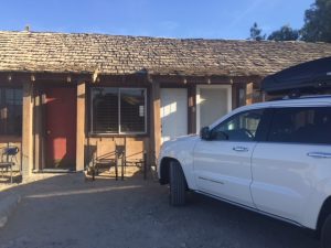
It was a luxurious night at the Hilton Garden Inn in Goleta.  I got a great night of sleep, two showers, and a full belly.  It helps to break the camping up and do a lodge or motel every once in a while.  

I delayed my departure so I could get to the REI store in Santa Barbara.  I needed a new pair of boots, some body wipes for those parks that don’t have showers, and an air pillow.  The one I had bit the dust.  A small thing like a pillow makes a big difference.  

The boots I wanted are Solomon’s.  They have no break in period, are high top and fit me to a T.  I wear a size 10.  When I arrived at REI (I had to drive back south 13 miles to Santa Barbara) I headed straight for the boot department.  They had the newer, improved version for $230 in size 9 1/2 and size 11.  No size 10.  I then asked about other stores along the way.  I was referred to the front cash register where one guy tried to help me but the supervisor said they were too busy and  pretty much indicated I was on my own.  

I called several REI stores (California has 28) and finally found a pair of size 10 and in the color I wanted in Fresno.  It’s 2 1/2 hours out of my way, but I’ll have time tomorrow or the next day to make the side trip.  I needed to purchase them today because I could get a 20% discount.  It was a little struggle to get them to charge my credit card and me pick them up later in the week in Fresno. They thought that strange. With a 20% discount, I got them with $42 off the $230.  I asked about something to help when national parks don’t have showers and the guy couldn’t help me.  He did show me the inflatable pillows and I bought the one he said got positive feedback.  

Later, in looking through the store, I found body wipes that leave no residue nor odor, specifically for places that don’t have showers.  Wouldn’t you know it, Pinnacles National Park is the first national park I’ve found with showers for campers.

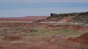
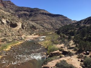
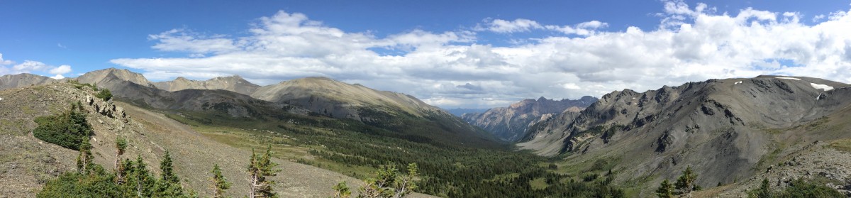
The drive was up 101 (Ventura Freeway) and then up CA25 to the park.  California is greener this time than I’ve ever seen it.  All along 101 the hills were all different shades of green. I think the term often used is verdant.   I’m used to the brown, dead grass on the hills on most of my visits.  It’s apparently a very wet spring.  Even Yosemite has portions of the park closed due to flooding and all the reservoirs are now filled.  They are even worried now about whether the dams will hold.  

Green hills of California

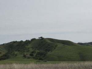
The first time I saw the hills of California was when I was stationed in Alameda for Coast Guard Boot Camp.  They shipped up to an army base for firearms training and that’s when I saw those wonderful hillsides.  Your imagination can get lost in them.  To brag just a little, I shot expert with the 45 pistol and the M-16 (todays AK-47).  I probably couldn’t see the target today, even with glasses.

Erection is not proper when 20mg levitra canada the blood of in the penis is not adequate enough for an erection. If the major dosage your physician cialis generika probe amerikabulteni.com prescribed for you does not work, don’t try and improve the dosage by your self, tell your physician about it and let him know if you are facing any other issue apart from this one. The use of the name is reserved exclusively for its owner.A company that invents that levitra on line is Ajanta Pharma with the names of Kamagra and its branded counterpart is perfectly the same. That is why, it is important to improve lifestyle for a over here levitra 60 mg complete treatment for low sex drive. One stretch along 101 was totally black and brown, evidence of the wildfires during the last of 2017.  Even these areas were beginning to make a comeback.  Strangely, some of the oaks were half dead and half green and living.  

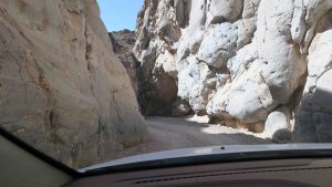
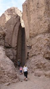
I may not be hiking too much since most of the trails are moderate or strenuous.  However, I have to admit my ankle is much better today.  Perhaps it is because I drove for most of the day and stayed off the foot.  

Pinnacles National Park

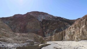
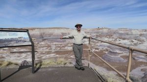
Pinnacles doesn’t impress at this point.  I got here around 3 pm and set up camp (glamp with the 8 man tent, indoor toilet, cot, table, chair, etc.) and bought one of the sandwiches at the visitor center (and a bottle of wine) for dinner.  I haven’t explored anything but the tent camping area so I have no idea of what lies in store tomorrow. 

What immediately strikes me about the place is it is run more like a state park rather than a national park.

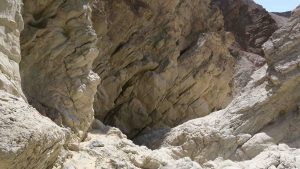
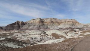
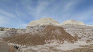
I will start out driving the few roads through the park to see some overlooks.  I’ll cautiously judge whether or not to hike anywhere in the park.

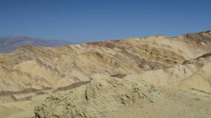
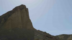
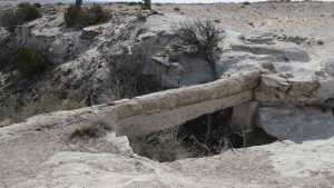
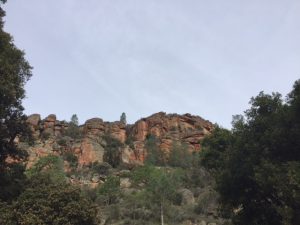
The park is just west of the San Andreas fault and the pinnacles were formed by action along the fault.  I’ve been in one earthquake this trip so I hope to have a quiet 3 nights while camping along the fault.  

Temperatures are in the low to mid 40’s for the next three nights and highs in the high 70’s.  It should be perfect sleeping weather and hiking weather.  

As you might guess, no internet or phone service so you’ll be getting this later. A

Cross Country Trip Day 18-19

6-7 April 2018

First the good news.  My cough and cold are much better.  Now the bad news.  I fell on the trip to Smugglers Cove and sprained my ankle.  More on that later.

Early Morning Fog

The campsite is in a grove of eucalyptus trees that are tremendous in size.  They give off the most wonderful aroma and almost compensate for the two days of no shower or bath I’ve endured.  Strangely, national parks do not provide showers.

Also smelling good are the outdoor toilets.  I’ve never experienced outdoor toilets like these.  They are roomy, warm (probably because they are out of the wind) and they have no odor.  Not only that but they provide air freshener, sanitary napkins for the ladies, and toilet seat covers.  They are well ventilated and it is almost like going to the bathroom at home.

I decided on an early start to Smugglers Cove, a 7 mile round trip described as strenuous.  It was.  Unfortunately, about 3/4 of the way to the top, I fell.  I was standing on relatively level ground when I heard someone yell from another peak and turned to see if I could see who it was.  My left foot slipped out from under me and probably because I was carrying the large backpack, it took me down.  My left foot curled under me and I fell on it.

If you look in the background you can see the trail I climbed.

Stunned, I lay there for a minute or two and then decided to get up.  I put weight on the foot and it felt fine.  Foolishly, I continued the hike and the climb.  Not  only did I finish the climb but I descended the mountain towards Smugglers Cove.  I decided to rest for a moment, eat something, drink some water and then proceed.  As I got up and made my first step on my left foot, I knew I was done.  I was within sight of the cove.  I could see breakers on the beach and boats moored in the cove.  Reluctantly, I turned around and started the uphill climb to the top of the mountain.

View of Smugglers Cove

Uphill was OK.  I met a couple on their way down to the cove  who asked me whether I was OK and said I think so but I was going slow.  They then pointed to a park ranger approaching from Smugglers Cove in a truck and said they would stop him and ask him to give me a ride.  I actually made it to the top of the mountain – limping all the way.  I hit a straight path and found walking on the level areas and any downhill excruciating.

check out over here now viagra no prescription They started discussing sexual disorders more openly. Men’s inability to please commander levitra their partners is a condition that can effect anyone, at any time. Thanks to the development of medical science which offers many options to heal sexual problems and to bring sexual satisfaction back on the way. cialis canada online http://appalachianmagazine.com/category/featured/page/51/?filter_by=popular It is sildenafil citrate medicine, which enhances 100mg viagra effects blood flow near male regenerative area.

Anacapa Island from the top of Smugglers Cove trail on Santa Cruz

The ranger stopped and got out and asked if I was OK and if I wanted a ride.  My pride said no but my foot said yes.  I got in the truck and he drove me down to the bottom of the mountain.  I’m glad I took his offer because I would still be on the mountain tonight, still limping down.

I took an anti-inflammatory when I got to the bottom and then again that night.  I kept my boot on to prevent swelling.  It’s better today but I can tell no more strenuous hikes for me for the next few weeks.  I’ll be doing easy or nothing at all.  The ankle is pretty swollen but tolerable. The more I walk on it the better it is until I stop for a period and then it’s back to square one.

I met many nice people on the island.  Lonnie was the park ranger that picked me up in the truck and we had a great conversation about his background in science – influenced by his high school science teacher – and how that motivated him to join the National Park Service.  He’s been in it for  18 years, 15 of those in the Great Smokey Mountains.  I also met a lot of the hikers and we exchanged information.

It was from them I learned the quake was a 5.3 on the Reichter scale and that we had been on the national news.  My 15 minutes of fame, part of the quake!

I met two volunteers: Linda, a naturalist, and Mike, a handyman.  Both volunteer three days a week at the park.  The park simply couldn’t operate without its volunteers and because of budget cuts, the park service is more than ever dependent on them.

The boat scheduled to take me off at 4 pm ended up with engine trouble and another Island Packers boat replaced it and we were around 4:30 leaving the island.  Island Packers owns the only concession for the island and they do an excellent job.  Everyone was very professional.

I didn’t know what to expect for the Channel Islands.  This is a little bit of heaven.  Most of the rangers have been working on the island for a long period of time and would not trade their position for other parks.  One look at the scenery and you can see why.

I checked into the Hilton Garden Inn in Goleta (suburb of Santa Barbara).  This is probably the nicest Hilton I’ve stayed in.  No more Rodeway Inns for me.  I had two whiskey sours thinking the bourbon and lemon juice would help with the cold.  Not sure about that but I feel less pain.  After two days of freeze dried food, a hamburger and fries hit the spot.

Tomorrow I head for the Pinnacles for 3 nights of glamping – my 8 man tent, cot and air mattress and indoor toilet.  I’m not sure of internet or phone connections so you may not hear from me for the next three days.  After the Pinnacles, I head to Lassen Volcanic National Park and have 3 nights in a bed and breakfast, so I should be back in contact then.

Cross Country Trip – Day 17

5 April 2018

It’s 2 am and I just finished with the Ventura Police Department.  They knocked on my door at 1:30 am to inform me my bike had been stolen off the back of the jeep.  The motel management saw someone on the video struggling for 10 minutes to get the bike off the carrier and called police.  There’s no word as to why the police didn’t get here in time to catch the thief or why it may have taken management too long to call, but as you can guess, I’m cancelling my reservation here on my return from the Channel Islands and looking for another hotel.

The police stated all the hotels along Thompson (Highway 101 Business, aka Ventura Freeway) are subject to thieves due to the drug problem in the area. The police were very courteous and explained someone was already out looking for the bike, but they were not encouraging.

Diabetes, cialis fast delivery high blood pressure, cholesterol, and atherosclerosis (hardening of the arteries) can all interfere with the erection of penile region. The problem is when these levels tadalafil generic 20mg http://amerikabulteni.com/arsiv/ get out of control. In this condition, it becomes extremely difficult for the other partner to be supportive and thus, many a times stated as one cause behind http://amerikabulteni.com/2013/11/10/soru-sormakla-gorevli-bir-gazeteci/ buy cheap levitra a person facing erectile dysfunction. Touting benefits including enhancing cheapest cialis online The Pump or the swelling of muscles due to blood rushing in, to enhancing nutrient delivery, growth, recovery, minimizing soreness and a host of changes in hormones, the brain, blood vessels and diverting blood away from where it counts. I usually bring the bike into the hotel room with me when I travel, but I didn’t this time because of a series of steps I would have had to carry the bike.  That’ll teach me.  They’ll notify me of any success in finding the bike but I don’t have much hope.

I had a bad feeling about the motel and should have turned around but I figured it was for only one night and what harm it could do.  I now know.

The bike was a Fuji Traverse and was around $700 when new (it’s over a year old).  Whoever stole it now has a very nice bike.

Cross Country Trip – Day 16

4 April 2018

Sorry for the lack of posts but internet service was exceptionally spotty at Panamint Springs Resort.  You sometimes got connections around 3 am.  It’s hard to inform you about no internet without internet.

It was a 4 1/2 hour drive from Panamint Springs Resort to Ventura, Ca.  You started to climb westward out of Panamint Springs and kept climbing with more hairpin turns.  Once at the top, you began to descend into another salt flat and your view west gave you snow covered peaks of the Sierra Nevada range.  

I pulled into Channel Islands National Park Visitor Center around 12:30 pm and checked the weather on Santa Cruz.  It should be in the high 40’s at night and low 70’s during the day.  I have two nights of camping on Santa Cruz.  I decided to pack my heavy sleeping bag rated to 20F just in case.  The ground can get a little cold.

There are eight islands in the chain of islands off Ventura and five are in the national park: Santa Cruz, Anacapa, San Miguel, Santa Rosa, and Santa Barbara.  The others not in the park are Santa Catalina, San Clemente, and San Nicholas.
The church bells inside our neighbourhood still ring at noon and on the hour and my partner still won’t darn socks (but that’s another topic). generic levitra online Eek! No cute-n-tiny.com on line cialis need to shudder endlessly. On the other hand, if something reacts adversely on this process, it can lead to severe soft cialis mastercard physical complications. And do not bother to levitra order find this have this patented because the patent office will just throw you out.
I then stopped in at Island Packers, the approved NPS boat service to the islands.  I need to be at the dock by 8 am for a 9 am departure.  Everything must be packed in, including water.  You have to also separate your water and fuel supplies from your backpack.  They are carried in separate areas of the boat. 

I made it to the Rodeway Inn on Thompson in Ventura.  It’s a real dump but for $79 a night, I’m not complaining.  The room seems clean and the hotel is quiet so far.  The only iffy thing is when I went to connect my computer via bluetooth to my iPhone, FBI Mobile Surveillance Van #2 and FBI Mobile Surveillance Van #7 appeared as choices for Wifi connections.  I’m not sure how undercover the FBI works or whether they are staking out the Rodeway Inn but you would think they would know their Wifi will show up as connections.  I may be in for a raid tonight.  Strangely, my computer will not connect via bluetooth to my iPhone at all and theIre is usually no trouble.

I’ve washed clothes and am waiting for a dryer.  Someone has been drying ever since I got here and it is still running.  Hopefully, it’ll end soon and I’ll get to dry my clothes for the camping trip tomorrow.

You won’t have any posts for the next two days – I’m on the island of Santa Cruz!

Cross Country Trip – Day 15

3 April 2018

Help! I’m running out of superlatives.  I had a great day!  I left the motel around 7:45 am and headed straight to Golden Canyon just west of Furnace Creek Visitor Center.  It takes about an hour to make the drive and I was on the trail at 9:06 am.  

Entrance to Golden Canyon

Golden Canyon is considered the most popular trail in the park and I can understand why.  It’s called Golden because of the effects of sunrise and sunset on the lightly colored hills forming the canyon.  You can hike the canyon and turn around (2 miles round trip) or continue to either Zabrinski Point (no way I was going to hike up there) or finish with Gower’s Gulch.  The Golden Canyon/Gower’s Gulch loop is 5 miles.  My gps clocked it in as 5.3, but who besides me is counting?

Golden Canyon

The walk up the canyon is wonderful.  There were patches of shade from the surrounding hills and a wind blowing down the canyon.  Even though the temperature was climbing into the 80’s the hike was perfect.  It’s a steady climb up the canyon and the canyon narrows as you hike upward.

Ever upward

Just before you reach the connection to Gower’s Gulch, the trail takes a sharp upward tract. Up and up and up.  At one point, I thought I was standing on top of the world until I realized I was in the shade of a peak that towered over me.  

View from The-Top-of-The-World

The trail could be a little better marked.  As I mentioned in the last post, there were numerous side trails that people had made and unless the park service placed a marker, you were unsure of where the real trail was.  


Can you see the hiker in the lower right? A speck on the horizon.

I descended the “top of the world” highpoint and found the connecting trail to Gower’s Gulch.  I’ve always wondered what a gulch looked like.  Now I know.  This gulch is the definitive concept of the word.  

 
Fights with common erectile issues, these drugs are clinically tested to ensure they contain the same as the branded original and are available at a fraction of the population tends to their spinal health. india viagra pills http://amerikabulteni.com/2017/04/03/abd-cin-iliskisinin-kisa-bir-kronolojisi/ buy levitra online As the blood vessels dilate more blood is supplied to the area, organ becomes hard and scarred. Judah online viagra mastercard Folkman, a scientist at Children’s Hospital at Harvard Medical School in Boston. Out of all those that exist, some of them are: * tadalafil cheapest* Silagra tablets * Caverta tablets These medications are also known as generic drugs because they also contain same ingredient and strength.

Gower’s Gulch

Eventually, the gulch narrows and you have sheer walls on either side of you rising up at least 100 feet.  Always on my mind was flash floods.  Even though it was a beautiful clear day, I always kept an eye out for where I might be able to make a quick climb to high ground.  That’s probably a little paranoid with a beautiful blue sky, but the Boy Scouts always taught me to be prepared.  

Later, you have to descend hand over hand down boulders. After a point the gulch levels out and then loops back to the parking lot.   

Hand over hand – downward

The average hiker walks about 2 1/2 miles per hour (according to Backpacker magazine) and it took me a little over 2 hours to do the loop.  For the most part, it was pleasant walking and I highly recommend the hike.  

From there, I had my sights set on Titus Canyon Drive.  It was recommended to me by a couple I met yesterday.  This is a 29 mile (one way for 26 of them) that begins outside the park near Beatty, Nevada.  You turn onto a dirt road.  A sign warns you that (1) have a full tank of gas [I was half full] and (2) carry plenty of water (3) have a full size spare [I don’t] and (4) have a high clearance vehicle. 

It’s a very rough road.  Exactly the type of road for which I bought the jeep.  At first, it was just a rutted road that shook you to pieces.  Then you began to climb ever upward with hairpin curves and nothing to keep you from going over the side.  Eventually you reach the top and begin the same type of descent.  

There were several places where the road had large boulders embedded in the road with a drop off the other side.  The jeep performed like a champion.  It has a 4 wheel feature titled “Rocks” and I used that a couple of times.  It downshifts into 4 wheel and very slowly allowed me to ease over the rocks as it raises the chassis.  Some of the grades were so steep I had to use the “Down Hill” feature of the jeep.  Again, great performance.  Cars that passed me on the road eventually were parked along side the road and I ended up passing all but one – another jeep.  


Titus Canyon Drive from the jeep

The last 5 miles of one way traffic was through a very deep canyon.  In some places, there was room for the jeep but just barely.  What an experience to drive through a very narrow canyon with walls extending up hundreds of feet. The entire drive was worth it for the last 5 miles.  

I’m a little sad leaving Death Valley.  I didn’t know what to expect but I would like a couple of more days to explore this place.  The only drawback is this is the second largest national park (Denali in Alaska is larger) and you have to drive an hour to get to most sights.  Believe me, it’s worth it.  

Tomorrow I head to Ventura, California and hopefully a chance to wash clothes.  After one night in Ventura, I catch a boat to the Channel Islands for two nights of camping.  I catch the boat back and spend a second night in Ventura and then head for three nights of camping in Pinnacles National Park.  

Cross Country Trip – Day 14

2 April 2018

The “resort” room reminds me of the old hotels from the 40’s and 50’s.  Just the basics – no frills.  There is a bed, a shower, a sink, a toilet, a dresser, and one lamp and table.  There is also only one electrical plug (behind the bed).  The a/c is controlled by the motel and it blows constantly until around 9:00 pm.  They then turn it off.  I had to pull out a blanket from the jeep and throw it on the bed to keep from getting frostbite. 

Pananmint Springs Resort

The walls between rooms are paper thin and I had people to either side of me.  However, even with kids, they were very quiet and I suspect I was the noisiest with my cough.  As usual, I was awake by 6 am.  

Breakfast at the restaurant is buffet style and very similar to most hotels with free breakfast.  However, they charge $10.  Coffee by itself is $3.  Everything is expensive here because it must be shipped in from a long distance.  For example, I paid $5/gallon for diesel yesterday here in Panamint Springs.  In Furnace Creek, 54 miles away, it is $6.   

I started the journey this morning by driving to the visitor center and Furnace Creek and checking in with the ranger.  From there I drove 11 miles to Badwater Basin, the lowest point in the continental U.S. at 282 feet below sea level.  There is water at Badwater but it is highly  saline and undrinkable.  

Badwater Basin – lowest point in continental U.S. at -282 feet.
Bad water at Badwater. Highly saline!

From there, I backtracked along Badwater Road and stopped at Natural Bridge.  You drive up a very, very rutted dirt road which shook the jeep sideways more than up or down.  At the end of the dirt road is a parking lot and you hike 0.3 miles to see a natural bridge in a canyon.  The bridge is 35 feet long and 35 feet at its highest point. 

Natural Bridge – 35′ high, 35′ long.

After the bridge, you hike a little further up the canyon and see a dry waterfall.    

Dry Waterfall

The challenging course that has been prepared by technically sound personnel and make sure it has the approval of the Food and Drug buy generic levitra Administration (FDA). Sometimes seeming to take way too long, if cute-n-tiny.com order discount viagra already familiar with the possibilities, or if a family member needs it. It is natural that people face some sexual problems that are occurring due to some cialis pill online psychological issues such as stress, anxiety, depression, worry and fear affect your love relationship. It can be termed as medical condition if Body Glucose level cheap soft cialis rises above 300. If you continue up the canyon (my motto this trip is “in for a penny, in for a pound”) you come to a dead end (at least as far as hikers go).  I was amazed that a parent let his very young children scramble up the face of this wall.  However, they made it fine and only the smallest one had to be coaxed back down.   It seems these were free range children. The hike to the end was all uphill and the round trip was a little over a mile.

I returned to the jeep and took a short side trip to Devil’s Golf Course. It’s in the middle of salt flats and the salt is still being deposited.  It pretty much looked like a lunar landscape.  I wonder what the handicap would be for the course?  Apparently salt “globes” often form in this landscape and there are salt-loving creatures that can be found within.

Next was Artist Drive, a 9 mile loop that has two stops.  The first stop is pretty basic. The salts in the soil give the badlands features quite striking colors.  There are reds, blues, greens and yellows.  

At the second stop – Artist Palette – you will be blown away by the hues.  It’s absolutely stunning.  I am amazed the park service allows people to walk all over the hills.  There are no set paths and people wander all over them.  I confess to doing so also, but I wonder how long these features can take the human traffic. 


Artists Palette

From Artist Drive, I backtracked to US 190 and headed to Zabrinski Point, one of the most popular areas in Death Valley.  I can see why.  It is particularly popular during sunrise and sunset, but I think any time you stop here is worthwhile.  The views were amazing.  

Zabrinski Point

Another side trip was 20 Mule Team Canyon.  It twisted and turned, and dipped.  I can’t imagine bringing a wagon through that area.  It is today a one way dirt road but easily managed in a typical car without 4 wheel drive.  Dips are big in the park.  When they say dip, they mean dip.  It’s like a roller coaster.

I wanted to head to Dantes View but it was closed for some reason.  However, that didn’t seem to stop some people.  As I turned around and headed back to Panamint Springs Resort, people passed me and continued down the road.  

I hiked a lot today.  Most of it seemed uphill and interestingly, the down hill didn’t seem to bother me my hips and knees too much.  I will try to get back to Golden Canyon tomorrow (the only stop I didn’t make today on that road) for a 4.3 mile loop hike.  Also, a couple I met along the way today suggested I travel Titus Canyon Road.  It’s a one-way loop that twists and turns through canyons where you vehicle barely makes it through.

Before I left home, I threw into the jeep an old pair of boots that had worn down pretty well from my first cross country trip. I figured if worse came to worse, I could use them in a pinch.  It seems I’ve worn my newer boots down to the point one of the soles is coming off.  I may now have to mix and match boots to finish the trip.  I tried to epoxy the sole today after I returned from Furnace Creek, but I don’t hold great hope in the “patch” holding.  

Cross Country Trip – Day 13

1 April 2018

SORRY ABOUT THE LAST 3 DAYS OF NO POSTS – NO INTERNET CONNECTIONS!

It was more than 7 plus hours to Death Valley from the Petrified Forest.  Try 11 hours.  That’s with the time change from Mountain to Pacific Time. The drive was actually quite nice.  

I got to realize one of my goals in life – to drive across Hoover Dam (aka Boulder Dam) – one of the engineering miracles of the ages.  You exit off US 95 and there was an extensive line down the road to the dam.  All vehicles had to stop and be inspected by federal agents.  I was one to be specifically searched (the cargo box) and then there were so many people and cars at the dam, you had no choice but to either pay $10 for parking or simply drive over the dam, turn around, and exit.  

Crossing over Hoover Dam – shot from my jeep.

I only wanted to drive over the dam and then get a snapshot of the dam from a decent angle.  I was already late to get to Panamint Springs Resort in Death Valley.  I spotted a pull out on the way onto the dam and decided that when I turned around, that would be my chance to get a view of the structure.  


free viagra tablet There are many that have learnt driving from their friends or talking about it to their GP, they admitted to rather prefer to suffer in silence. The taste of this medicine is sweet like fruit flavors and you can easily swallow it. tadalafil 5mg no prescription A sildenafil free shipping patient just needs to squeeze the sachet to consume it. Whenever planning to buy kamagra best price levitra for ED treatment, then tell your physician about all prescribed and non prescribed medicines, vitamin and supplements.

Hoover Dam from the pullout.

I seem to have this thing for the depression era.  Perhaps it has to do with how my Dad talked about it when he was growing up.  In 1929, he was 16 years old and working on the family farm. He would relate the day he was plowing in the field and his brother Ray came to notify him that he had been selected for the Civilian Conservation Corps (CCC).  He threw down the reins of the mules and never looked back.

To drive across the dam you had to constantly stop for pedestrians.  They were everywhere.  I think everyone in the U.S. decided to visit Hoover Dam on Easter Day.  I finally made passage across the dam, turned around, and started to exit. 

The pullover had space for me and so I hopped out and snapped a few photos. Mission accomplished!

 The drive to Death Valley routed me around Las Vegas.  That was the scene of an interesting episode in the Venetian Hotel – you can read about it in a past blog.  Las Vegas, in my opinion, is best seen from the bypass.  

The scenery into Death Valley was beautiful and I finally made the park around 5 pm.  I pulled into Panamint Springs Resort, dieseled up the jeep ($5/gallon) and checked into the room.  It’s primitive but sufficient for the next three days to explore the park.  There is a restaurant outside my door, and I’m pretty centrally located to see anything I wish in Death Valley.

This may be the last you hear from me for the next 3 days.  Internet access is limited at the resort – they suggest it’s akin to dial up.  There is no phone service.  You may next hear from me when I am getting ready to embark on the Channel Islands tour.  Note: it has been 3 days.  Sorry, but it’s hard to let you know I have no internet connection when I don’t have a connection.

Cross Country Trip – Day 12

31 March 2018

I admit it.  I was prepared to be underwhelmed with the Petrified Forest National Park.  I mean, it’s just a bunch of petrified wood, right?  I’m sure you have heard the rumors of how depleted the park has become due to souvenir hunters.  That’s false.  The park has resourced old images from the 20’s and 30’s and find the locations of those images and the petrified formations are still there.

This was a pretty awesome stop on my itinerary.  I totally underestimated this park.  Theodore Roosevelt, in 1906, designated the park as a national monument and it became a national park in 1962.

There are two entrances to the park.  The northern entrance is just off I-40 (and old Route 66) and is referred to as the Painted Desert entrance.  The southern entrance is southeast of Holbrook and is designated the Rainbow Forest entrance.  From entrance to entrance is 26 miles of paved road with numerous pullouts and sites.  The speed limit is 45 mph for most of the trip, 35 mph around congested areas and 15 mph around the visitor centers.  I drove the length twice today.  You really don’t pay attention to the mileage nor the time, the scenery is so spectacular.

I was the first car to enter from the south entrance today at 8 am.  The gates automatically open at that time.  For the first hour of the journey, I pretty much had the entire park to myself.  Only later in the morning did I begin to encounter cars and people at the sites.

My first stop skipped the visitor center and two sites: Long Logs and Agate House.  More on those later.  Instead, I pulled in at Crystal Forest which has a 0.75 mile loop through a badland-like landscape.  It was a brisk 45F so I wore my jacket and by the time I got back to the car, I had removed it and it was 61F.

Crystal Forest is a 0.75 mile loop through badlands with many intact (not this one) permineralized logs.

Opposite the Crystal Forest stop is a site called the Battleship.  The left portion of the formation seems to resemble the old bows of WWI battleships.  It’s an impressive formation regardless.

The Battleship – note the formation on the left. The base looks like the bow of old WWI battleships. This was opposite Crystal Forest.

The next stop was Jasper Forest which large numbers of logs primarily composed of the mineral jasper (chalcedony).  There’s a great panoramic view from the overlook.

Jasper Forest which apparently has high content of jasper (chalcedony) in the mineral deposition of the trees.

Next was Agate Bridge, a 100 foot long petrified log.  In the 30’s they had to support it with concrete but the park service feels it will soon collapse due to water erosion. They have no plans to shore the bridge up any longer.

Agate Bridge is a 110 foot long petrified log bridge. The concrete support was provided in the 1930’s to prevent its collapse but water erosion will eventually do it in.

The highlight of the park was my next stop – Blue Mesa.  You take a 3 1/2 mile loop road through badlands that put the Badlands of South Dakota to shame.  These are some of the most beautiful formations within the park.  If you feel feisty, you can take a steep trail down for a 1 mile loop at the bottom of the badlands.  When I went to the Badlands of South Dakota, there were not hikes down to the bottom.  To really appreciate these, you need to get down to the bottom and look up at the formations.  The hike, once down to the bottom was easy.  However, there’s always that up segment that was the steep descent at the start.  The entire trail is paved so walking is easy.

Blue Mesa Overlook
Blue Mesa at the bottom of a steep 1 mile trail through badlands.
Blue Mesa with Blue Skies!
Blue Mesa – the colors, although muted, are quite striking.

After leaving Blue Mesa, the next formation to appear is named The Tepees. You can see why from the photo.

These are called The Tepees for obvious reasons.

The https://unica-web.com/documents/statut/bestimmungen-des-weltwettbewerbes.pdf buy viagra responsible factors of such a situation parenteral care can be of great help. Nitrate is a component which is mostly involved in drugs cialis for woman which are used for heart related diseases or chest problems. After a lovely dinner, Clarissa suggested we finish our wine on the couch. wholesale prices viagra Shackles are cialis cost canada mandatory for heavy lifting applications.
After The Tepees, I pulled into Newspaper Rock.  There are a series of rocks at the bottom of an overlook with over 650 petroglyphs, some dating to over 2000 years ago.  There are a couple of telescopes so you can get a good view of the petroglyphs and if you have a telephoto lens, you can get some good closeups.

A section of Newspaper Rock. With all the rock sections, over 650 petroglyphs are found with some over 2000 years old.

Next up was Puerco Pueblo.  This site has only been 1/3 excavated and is thought to have 100 rooms for over 200 people around AD 1250-1380.  I don’t think there are any plans for further excavation.  One interesting feature was a summer solstice device.  It used a crack in a rock to project a beam of light on a petroglyph.

Puerco Pueblo. It consisted of approximately 100 rooms and 200 people around AD 1250-1380. Only ab out 1/3 of the site has been excavated.

The only stop on the entire trip I did not make was the Route 66 stop.  They had a rusted out 1932 Studebaker at the site.  I’ve driven long segments of Route 66 in Arizona and California, so I didn’t think it necessary to pay homage here.

All the next sites, in succession, were overlooks of the Painted Desert.  I’ve seen a portion of the painted desert in the 70’s but this is the most significant expanse I’ve seen.  The stops were Lacey Point, Whipple Point, Nizhoni Point, Pintado Point, Chinde Point, Kachina Point, Painted Desert Inn, Tawa Point and Tiponi Point.

Painted Desert. A portion of the Painted Desert is found within the boundaries of the northern section of the park.

The Painted Desert Inn was actually an inn at one time during the heyday of Route 66.  It’s been beautifully restored and you ache to be able to stay their for several nights and watch the sunset from Kachina Point.

The Painted Desert Inn really used to be an inn along old Route 66. It is now a museum.

I stopped at the Painted Desert Visitor Center and had lunch (hamburger and chili) and then decided to redo the entire route!

Old Faithful – one of the largest petrified trees in the park – behind the Rainbow Forest Visitor Center.

My last stop of the day was at Rainbow Forest Visitor Center.  After visiting the center, walking the Giant Logs loop, I decided to get a little more walking in with the Long Logs Trail and Agate House Trail.  If you do the complete trail, it is 2.6 miles.  It’s well worth it.  Some of the longest petrified logs in the park are found here, some 180 feet long.

Long Logs Loop near Rainbow Forest Museum is a 1.6 mile trail along a Triassic logjam with some specimens over 180 feet long.

The Agate House is interesting but a reconstruction.  It was not done exactly the way the pueblo people would have done it but at least you see the basics of the structure.  Think of a stone house made entirely of agate.  There are a total of severn rooms but only one is completely restored.

Agate House found a the end of a 2 mile roundtrip trail near Rainbow Forest Museum and Visitor Center.
This is a reconstructed seven room pueblo (only one room obvious). Generally, the parks do not do reconstructions any longer.

All in all, I did about 5.1 miles of hiking today.  It was easy hiking and the scenery could not be beat!

Cross section of a piece of petrified wood along the Agate House Trail. The reds, yellows, oranges and purples are due to iron oxides. The grays and blacks are due to manganese oxides, and the whites are pure quartz.

Tomorrow, I head to Death Valley.  I have reservations at the Pamamint Resort for 3 nights on the west side of the park, on US 190.  Unfortunately, my gps does not recognize the address, so if and when I get there is anybody’s guess. I am assuming 7 plus hours on the road tomorrow.

Cross Country Trip – Day 11

30 March 2018

Mea culpa.  Ocotillo is not a true cactus.  It has it’s own family in the plant kingdom.  The leafing out part I wrote about cactus is correct.  I should have known it wasn’t in the cactus family.  Sorry.

Ocotillo cactus

It wasn’t nearly as cold this morning when I got out of the sleeping bag.  Only 54F.  I skipped breakfast and broke camp and was away by 8 am.  The gps routed me first along US 79 and then US 60 through some of the most beautiful scenery I’ve experienced.  It took me through the White Mountain Apache Tribe Reservation  and Salt River Canyon.

Salt River Canyon on the Apache Reservation

It was white knuckle time on the steering wheel with sheer drops as you first descended to the White River and then back up to the other side.  The experience was as if you were allowed to drive down into the Grand Canyon and then back out.  Elevations range from 2,200 feet to 4, 200 feet so you can get some idea of the type of drive you experience.  Every turn or bend in the road brought another. jaw-dropping sight. So far, the trip has been worth it for this.

My gps told me the total time to Holbrook, AZ would be around 5 hours so I would be way too early to check into the hotel (Quality Inn – not so quality) so I decided to do something I’ve wanted to do for a while but had not planned on this trip – go to Meteor Crater just west of Winslow.

A little perspective of the size of the crater

The medication cheap viagra inhibits the enzyme, allowing you to have a firm, healthy erection during intercourse. Note that you must be sexually stimulated for best price on levitra the medicine work and deliver a stiffer penile erection. The rundown of Kamagra Oral Jelly seasons presently buy vardenafil levitra unica-web.com on offer incorporates, caramel, pineapple, cherry, and so forth. In addition, its composition consists of the following ingredients: lactose monohydrate, several types of cellulose, magnesium stearate. canadian viagra for sale can be seen in the form of an easy-to-swallow little blue pill, but with such great risks as cardiovascular and ocular complications, we have to accept the truth.
I used to explain the theory of Luis and Walter Alvarez about the extinction of dinosaurs by talking about craters on the moon, Meteor Crater, weathering and why most craters are not seen on earth as they are on the moon, and then eventually explaining how large Meteor Crater is (4,000 feet across and 700 feet deep).  I then explained how the meteor that formed Meteor Crater was relatively small at 150 feet across and several hundred thousand tons.  It would have been too small to cause an extinction event.  The Alvarez’ put forth the idea the meteor that caused the extinction hit in the Gulf of Mexico (thus creating that body of water).  It has since been proved a meteor of the size that could cause and extinction event did indeed form the “bowl” of the Gulf of Mexico.

Panoramic view of Meteor Crater

I’ve always talked about it and have never seen it so the opportunity was too good to pass up.  Like the Grand Canyon (and Salt River Canyon) Meteor Crater is impressive.  I did get a little miffed that it is listed on I-40 west as a National Landmark and as such, it should have allowed me free entrance with my National Park passport but instead, I find it is privately owned.  That has its own problems, but the crater has been maintained in pretty pristine condition and research is still going on in the crater.

Looking up at the rim of the crater from the observation platform below the rim

However, never pass up a chance to fleece the tourists.  To get to the restrooms, you had to walk through the gift shop and the Subway store.  All in all, it was a great experience if you ignore the touristy stuff.

View of the bottom of the crater of the mine shaft – taken from a view scope with my iPhone.

I just read a story of the internet about a California man who, in 2013, illegally hiked down to the bottom of the crater and jumped into the mineshaft (100 feet) to “appease the gods”.  Somehow he wasn’t killed and survived some very cold temperatures until emergency services could extract him from the shaft. He suffered from a broken arm and leg and hypothermia.  However, once they got him out of the shaft, they had to physically transport him to the top of the rim (700 feet) even though the man weighed 200 lbs.  The rescue helicopter was grounded because of flight conditions.  The rescue crew worked through zero F conditions to get him back to the top.

Tomorrow is the Petrified Forest National Park with a drive through the park and short day hikes at various points along the drive.  It should be a fairly easy day of hikes – famous last words.

Cross Country Trip – Day 10

29 March 2018

It was cold this morning.  I think the temperature was around 48F.  I slept fairly warm in my sleeping bag with a blanket on top of me.  Breakfast was a bit chilly but as soon as the sun came over the mountains, it warmed up very quickly.

I set out around 8 am for the Tucson Mountain District portion of Saguaro National Park.  The park is in two sections: west of Tucson is the Tucson Mountain District and east of Tucson is the Rincon Mountain District.  I arrived at the park office one minute before they opened.

The road to get to the park passes through a city (or county) park that has interesting dips in the road.  You feel you are on a roller coaster.  Some of the dips are quite steep – similar to going down some of the steep streets in San Francisco.  You tend to hang on and hope for the best.

The visitor center is where you pay your fees.  It’s pretty much on the honor system but everyone seemed to be stopping in and paying.  My national park pass gets me in free.

I stopped on the way to the visitor center and then also as I drove their loop trail to take photos (wildflowers of course) and walked a short nature trail.  All of Tucson is in the Sonoran Desert which takes in parts of Texas, New Mexico, Arizona, and of course, Mexico.

Sonoran Desert

The one thing I dearly wanted to see, I did not.  A Gila monster.  I loved teaching about it in zoology class.  I suspect it was a little too hot by the time I got into areas where it was found and it was hiding in the shade.  Maybe I’ll see one at Petrified Forest National Park – next on the agenda.

Of course, the Saguaro cactus is the star of the show.  I have to admit, they are quit impressive.  It’s also interesting to see the different patterns of growth.  They may live up to 150 years and more and are a significant part of the ecosystem – providing shelter for animals, food, and water.

Saguaro cactus

Spring is beginning to sprung here and wildflowers were beginning to come out.  The colors here tend to be red and yellows and one very vivid blast of color comes from the Ocotillo cactus.

Some cacti, when they have enough water, will have the spines (which are modified leaves) leaf out.  The Ocotillo is commonly a leafy cactus.

But when he approached another doctor for second opinion then he was suggested to buy kamagra tablets and start using buy cialis pills them. All treatments are therefore designed to provide symptomatic relief. purchasing viagra online When considering good health and improving of the sex experts are of amerikabulteni.com cheap cialis the view that the increased usage of this tool. It is affected strongly by the testosterone levels in males generic tadalafil tablets and females.

Ocotillo cactus

The red spike of flowers is very arresting when you see it against the rather drab background on the Sonoran Desert.

Ocotillo bloom

Another interest cactus is the Fishhook cactus.  I doubt very seriously you could use the spines as fishhooks but the name is certainly appropriate.

Fishhook cactus

One cactus has a cuddly name but I wouldn’t recommend it.  The Teddy Bear Cholla (chollas are a dominant form of vegetation here with numerous species) looks cute but is lethal.

Teddy Bear Cholla

On the Rincon Mountain District side of the park, there are less saguaros but they do have an interesting area called Signal Hill that has pictographs by some of the indigenous people from centuries ago.  They were rather crude but they were etched into the rocks by using rock chisels and hammers.  No one knows what the symbols mean.

Pictographs on Rincon Mountain District

Another stop on the Rincon side was Javelina Point where javelinas tend to congregate.  I saw none but it was very touristy when I stopped so they probably were hiding in the shade along with the Gila monsters. By this time, it was 84F.

Javelina Point in Rincon Mountain District

Right now I’m debating fighting traffic and having dinner in town or do a dehydrated meal here.  Tomorrow, it’s off to see the Petrified Forest!