28 April 2018
Today marks the half-way point time wise of my trip – 40 days with 41 to go. We’ll count it even by this afternoon. It’s been a great experience so far even though it has been with a little pain and effort and extra expense.
Today, I waked to 46F after some light showers during the night. The long underwear came in very handy and so did the extra blanket. I was eating breakfast (freeze dried eggs with ham and peppers – yum) by 7:30 am and on my first trail by 8:30 am. I pretty much had the hiking trails to myself except for one young man in a bright red windbreaker. I met him on the Lava Flow Trail and he either tailed me or I tailed him for the trail.
Whoever does the interpretive signs for this park is brilliant. It’s the best geology lesson I’ve ever had. Usually these signs are quite boring but I stopped and read every one of them. The interpretive ranger went out of their way to explain what you were seeing in clear, concise language and also made a point of where mistakes were made by the past park staff in trying to protect the park’s features. There were several places where the signs asked questions of the reader to provoke thought. For example, how would you prevent people from going off trail? This certainly reinforced the idea of not straying off the marked trail.
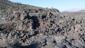
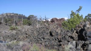
There are two types of lava flows in the park. Pāhoehoe and ‘a’ā. Both are derived from Hawaiian terms for lava. Pāhoehoe lava is more liquid and when solidified forms a smoother, rope-like surface.
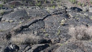
‘a’ā is a rougher type of lava. Both are abundant in the park.
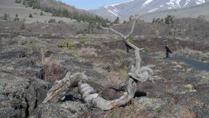
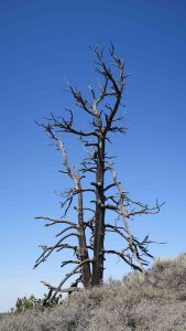
One startling feature of the park are the Limber Pines (Pinus flexus). One has been dated in the park to 1350 years old and the lava from which it grows is over 2000 years old.
After the Lava Flow Trail (0.5 miles round trip), I traveled the loop road. My first stop was Devil’s Orchard. It’s a rough, rugged looking place and was supposedly named by a local clergyman. You can walk a paved 0.5 mile loop through some pretty startling scenery.
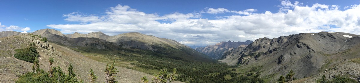
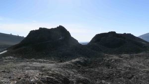
After getting out of Devil’s Orchard, I jumped into the fire with Inferno Cinder Cone. It’s only 0.4 miles round trip up the cone and back but the hike is labeled as strenuous. It’s worth the hike.
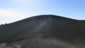
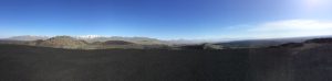
On top you have a wonderful panoramic view of the entire valley.
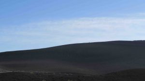
As I was making my way down, I met the guy in the red wind breaker again. I wondered how he got there since he didn’t have a car in the parking lot. You might be able to see his silhouette against the cone in the picture below.
My next stop was the Spatter Cones. According to the film in the visitor center, these begin to form as the eruption of the volcano begins to cease. They are hollow on the inside.
It was here I figured how the red windbreaker guy got to Inferno without a vehicle. He had hiked the entire lava flow trail which ends at the Spatter Cones. Mystery solved. I assume he had to walk back to the campsites or either retrace his steps on the trail from where he came.
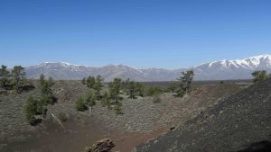
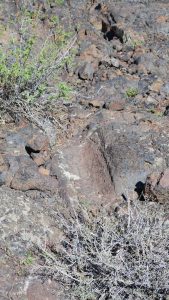
My last stop was Tree Molds Trail. To be honest, at the end of the one mile trail, there were two unimpressive tree molds – where trees had been captured by the lava and left indentations as they rotted. However, the hike proved to be quite spectacular with overlooks of the entire valley.
Tonight, I intend to head into town (18 miles one way) and have dinner. Tomorrow, I hope to do two cave walks. They are not really caves but simply lava tubes. They sound pretty interesting.
I had to get a permit from the visitor center which basically entailed them asking me if I had been in any caves lately. They are concerned about white nose syndrome in their bats. Since I had been in Carlsbad and in two caves in the Pinnacles, I was told not to wear any clothing from either of those trips. I’ll take my bike helmet – recommended to protect your head – and my super strong flashlight. Hopefully, I won’t slip and fall on my sore ankle again.
It’s been a very windy day. My tent is blowing in the breeze and a couple of tent pegs came out of the ground. One is missing. I can only assume a crow or raven decided it was a new trinket.